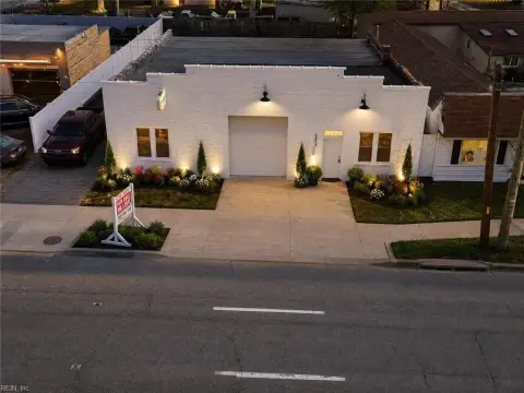
31 Delta Cir Newport News, VA 23601-3117
Single-Family Dwelling District, R-2 Single-Family Dwelling District, R-3 Single-Family Dwelling District, and R-5 Low Density Multiple -Family Dwelling District. None of the aforementioned zoning districts provide any measures to specifically address redevelopment or future development adjacent to or within close proximity to Fort Eustis. The zoning ordinan…
Cap rate
Implied · in-place · derived from last sale + estimated NOIValue
AI, CAP & Alternative Use estimations · Realmo proprietary blendProperty tax & assessments
Tax year 2023Comparables
6 recent transactions · within 1.5 miComparable in this City


Similar Nearby for Sale




Similar Nearby for Lease


Property description
Physical attributes from public recordsZoning & alternative use
R3 · Newport News, VASingle-Family Dwelling District, R-2 Single-Family Dwelling District, R-3 Single-Family Dwelling District, and R-5 Low Density Multiple -Family Dwelling District. None of the aforementioned zoning districts provide any measures to specifically address redevelopment or future development adjacent to or within close proximity to Fort Eustis. The zoning ordinance could be amended to create a Military Influence Area Overlay District that applies directly to Fort Eustis and portions of the surrounding areas. The intent of the overlay district would be to protect the mission footprint of the installation and to r educe potential encroachment issues related to existing development, new development, or potential redevelopment surrounding the installation. 6.4.3 Toward 2035 Leading the Way: James City County Comprehensive Plan The purpose of the James City County comprehensive plan is to guide growth and development over a 20-year period by providing the long-range vision, goals and strategies of the community. James City County adopted its first comprehensive plan in 1975, which established the foundation for managing growt h in the County. James City County’s current plan, Toward 2035: Leading the Way, was adopted in 2015, with a planning horizon of 2035 and contains a total of 11 separate elements as listed below: ▪ Demographics ▪ Population Needs ▪ Housing ▪ Economic Development ▪ Environment ▪ Community Character ▪ Parks and Recreation ▪ Public Facilities ▪ Transportation ▪ Land Use ▪ Land Use Map Descriptions and Development Standards Fort Eustis Joint Land Use Study Compatibility Tools Chapter 6 Local Programs and Plans Page 58 The James City County comprehensive plan serves as a guide to landowners, developers, businesses, citizens, and County officials about future land use decisions. Application to the Fort Eustis Joint Land Use Study A 24 acre portion of Fort Eustis is located within James City County across from the main installation on the north bank of Skiffe’s Creek near the mouth of the James River. The 24 acre tract of land is designated as Federal, State , and County on the 2035 Land Use Map. The area directly adjacent to the 24 acre tract and to the north of the main installation is privately owned and is designated General Industry on the 2035 Land Use Map. Several of the elements within the comprehensive plan contain goals with associated strategies and a ctions that would assist in addressing areas of concern as identified in the JLUS.
No recorded transactions found for this property.
Costs & Benchmarks
Operating expenses, capex projections, utility benchmarks, and submarket comparables — all in one view.
Risks
Flood, climate, environmental, title, and tenant-concentration risk — surfaced with mitigations and source citations.


