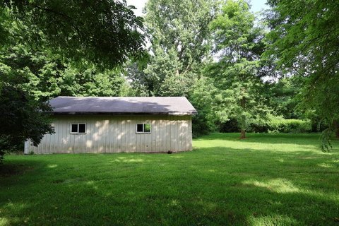
29730 King Rd Leonidas, MI 49066-9721
Property profile & analytics
29730 King Rd, Leonidas, MI 49066-9721
- Commercial land
- 3.84 lot acres
Property ID
US43-2281218
The Realmo ID is a unique identifier assigned to every property, incorporating country codes and precise geo-coordinates for 300x300-foot land blocks. It enables standardized data collection and seamless integration of disparate sources such as ownership, tax, title data and physical specifications. By aggregating current and historical records, the Realmo ID powers advanced analytics and delivers deep, verifiable insights for real estate professionals.
Location Intelligence
Current Use by Public Records
- Commercial land
Property Details for 29730 King Rd
- Lot size
- 3.84 lot acres
- Property type
- Commercial land
- APN
- 008-020-004-00
- APU
- 802000400
Sales History
| Date | Price | Buyer | Seller | Deed Type | Mortgage |
|---|---|---|---|---|---|
| Jun 6, 2012 | $5,000 | Steven Ray Gilbert | St Joseph County Board Of Commissio | Corporation Deed | — |
| Mar 29, 2011 | $50,000 | St Joseph County Board Of Commissio | Laverne Plair | Warranty Deed | — |
| Jul 21, 2010 | — | Laverne Plair | Eddiess M Hughes | Quit Claim Deed · related | — |
| Aug 20, 2009 | — | Laverne Plair | Laverne Plair | Intrafamily Transfer · related | — |
Value Estimations
based on Realmo’s proprietary methodology
-
AI approach
-
CAP approach
-
Comparable approach
-
Alternative Use
Get a detailed, property-specific estimation — fast and free
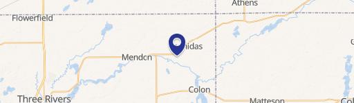
Location Insight
- Map
- Local Demand
- City
- Leonidas
- County
- St. Joseph
- State
- Michigan
- Longitude
- -85.3759
- Latitude
- 42.025
- CBSA code
- 44780
- CBSA name
- STURGIS, MI MICROPOLITAN STATISTICAL AREA
Property Tax & Assessments
Tax date
Tax Amount
Assessed Land Value
Assessed Improvement Value
Total Assessed Value
Applied Tax Rate
Land Market Value
Improvement Market Value
Total Market Value
2023
$0.00
$0.00
$0.00
$0.00
-
$0.00
$0.00
$0.00