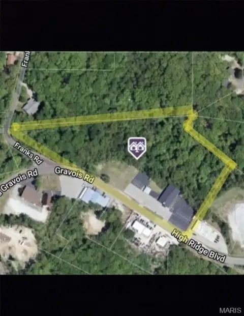
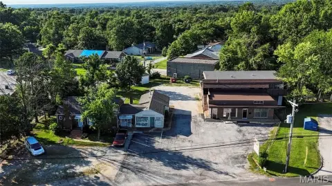
2796 High Rdg Blvd High Ridge, MO 63049-2233
Property profile & analytics
2796 High Rdg Blvd, High Ridge, MO 63049-2233
- Distribution centers
- 7,320 SF
- 1.10 lot acres
Property ID
US48-0597576
The Realmo ID is a unique identifier assigned to every property, incorporating country codes and precise geo-coordinates for 300x300-foot land blocks. It enables standardized data collection and seamless integration of disparate sources such as ownership, tax, title data and physical specifications. By aggregating current and historical records, the Realmo ID powers advanced analytics and delivers deep, verifiable insights for real estate professionals.
Location Intelligence
Current Use by Public Records
- Mid-Continent Label & Tag / Marketing & Advertising / Printing Service
Property Details for 2796 High Rdg Blvd
- Year built
- 2005
- Lot size
- 1.10 lot acres
- Zone code
- CC-2
- Property type
- Distribution centers
- APN
- 03-6.0-13.0-3-001-004.01
- APU
- 360130300100401
Sales History
| Date | Price | Buyer | Seller | Deed Type | Mortgage |
|---|---|---|---|---|---|
| Feb 17, 2026 | — | Mid Continent Label & Tag INC | Christopher R Klohr | Quitclaim Deed · related | — |
| Apr 13, 2004 | — | Christopher R Klohr | Rothenberg,robert L | Warranty Deed | $148k · Commerce Bank NA |
Value Estimations
based on Realmo’s proprietary methodology
-
AI approach
-
CAP approach
-
Comparable approach
-
Alternative Use
Get a detailed, property-specific estimation — fast and free
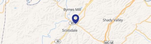
Location Insight
- Map
- Local Demand
- City
- High Ridge
- County
- Jefferson
- State
- Missouri
- Longitude
- -90.5301
- Latitude
- 38.4632
- CBSA code
- 41180
- CBSA name
- ST. LOUIS, MO-IL METROPOLITAN STATISTICAL AREA
Property Tax & Assessments
Tax date
Tax Amount
Assessed Land Value
Assessed Improvement Value
Total Assessed Value
Applied Tax Rate
Land Market Value
Improvement Market Value
Total Market Value
2023
$9,137
$30,700
$92,400
$123,100
-
$95,800
$288,700
$384,500