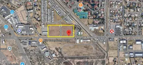
2700 Airport Rd Santa Teresa, NM 88008-9713
Property profile & analytics
2700 Airport Rd, Santa Teresa, NM 88008-9713
- Distribution centers
- 111,711 SF
- 6.77 lot acres
Property ID
US61-0015037
The Realmo ID is a unique identifier assigned to every property, incorporating country codes and precise geo-coordinates for 300x300-foot land blocks. It enables standardized data collection and seamless integration of disparate sources such as ownership, tax, title data and physical specifications. By aggregating current and historical records, the Realmo ID powers advanced analytics and delivers deep, verifiable insights for real estate professionals.
Location Intelligence
Current Use by Public Records
- Distribution centers
Property Details for 2700 Airport Rd
- Year built
- 1998
- Construction
- CONCRETE
- Lot size
- 6.77 lot acres
- Zone code
- REMOTE-MESA
- Property type
- Distribution centers
- APN
- 4-012-165-179-484
- APU
- 4012165179484
Sales History
| Date | Price | Buyer | Seller | Deed Type | Mortgage |
|---|---|---|---|---|---|
| May 7, 2025 | — | Ld Cobb Family Cal 1 LLC | Ld Cobb Family Cal 1 LLC | Deed · related | — |
| May 2, 2006 | — | Ld Cobb Family Cal 1 LLC | Club Deal 35 Airport II | Grant Deed | — |
| — | — | Ld Cobb Family Cal 1 LLC | — | Deed Of Trust · related | $400k · Premier Valley Bank |
Value Estimations
based on Realmo’s proprietary methodology
-
Comparable approach
- Method
- Estimation
- AI Estimate
- $5,002,000
Market price range: $2.48M - $6.88M -
Alternative Use
- Use
- Estimation
- WAREHOUSE, STORAGE
- $4,565,000 Current use
- RETAIL STORES
- $9,715,000 Change: +113% Conversion: Moderate
- APARTMENT HOUSE (5+ UNITS)
- $9,425,000 Change: +106% Conversion: Difficult
- COMMERCIAL (GENERAL)
- $8,910,000 Change: +95% Conversion: Difficult
- NEIGHBORHOOD: SHOPPING CENTER
- $5,410,000 Change: +19% Conversion: Moderate
Get a detailed, property-specific estimation — fast and free
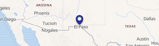
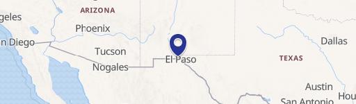
Location Insight
- Map
- Local Demand
- City
- Santa Teresa
- County
- Dona Ana
- State
- New Mexico
- Longitude
- -106.695
- Latitude
- 31.8663
- CBSA code
- 29740
- CBSA name
- LAS CRUCES, NM METROPOLITAN STATISTICAL AREA
Property Tax & Assessments
Tax date
Tax Amount
Assessed Land Value
Assessed Improvement Value
Total Assessed Value
Applied Tax Rate
Land Market Value
Improvement Market Value
Total Market Value
2023
$59,717
$196,330
$1,592,018
$1,788,348
-
$588,990
$4,776,054
$5,365,044