Back to Search
Property profile & analytics
OFF-MARKET
Grocery and convenience stores
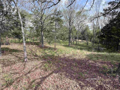
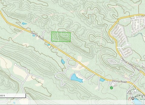
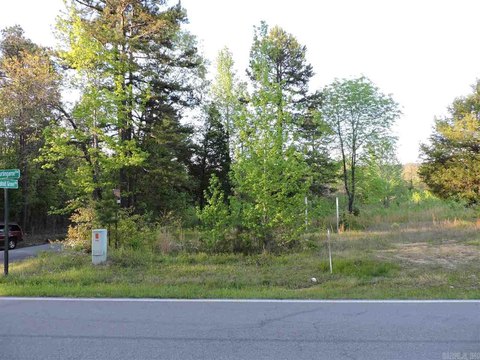
26910 Kanis Rd Little Rock, AR 72223-9594
Entity Owned
5-yr Hold
Absentee Owner
~
Est. High Equity
Property ID
US05-0134347
Property profile
Verified
Property type
Grocery and convenience stores
Use group
CONVENIENCE STORE
Year built
2000
Total area
4,180 SF
Lot
2.79 ac (121,532 SF)
APN
63R-025-03-001-00
UPID
US05-0134347
Cap rate & NOI
Priority signal for investors
Implied cap rate, NOI & suggested price
Cap rate vs submarket · NOI estimate · 3 price anchors
Implied cap rate, NOI & suggested price
Cap vs submarket · NOI estimate · 3 price anchors
Current use
Occupant on record · Public records
-
Phillips 66 Gas Station
-
Western Union Bank Credit Union
-
ATM (ATM Link, Inc.) Atm
-
Bear Creek Country Store Grocery & Convenience Store Food Market
-
Philips 66 Gas Station
Value estimations
Realmo proprietary · 4 methods
AI Approach
AI
by Request
CAP Approach
CAP
by Request
Comparable Approach
Comparable
by Request
Blend (final)
Blend
by Request
Owner & transaction history
Sultanas Property LLC · 5 yrs held
Sultanas Property LLC
since 2021
Last sale
$125,000
4 recorded transactions
Zoning & alternative use
Permitted uses
Permitted uses
Allowed · conditional · prohibited
Cap rate
Implied · in-place · derived from last sale + estimated NOI
Implied Cap rate
#1
Implied · in-place · NOI ÷ last sale
In-place · derived from last sale + estimated NOI
Cap rate, NOI & submarket benchmark
Implied cap rate vs Little Rock submarket · NOI estimate · Typical band, median & reading
Implied cap rate, NOI & submarket benchmark
Cap vs Little Rock submarket · NOI estimate · typical band, median & reading
Refine your cap rate
8-question underwriting flow
1.
Property current status — Going-In vs Stabilized
2.
Price for denominator — asking / offer / market
3.
Leasing status & lease structure (NNN / Gross)
4.
Tenant risk profile & vacancy assumption
5.
Upload T12 / rent roll / OM (optional)
Refine in 60 seconds, get exact suggested price
T12 upload · Submarket benchmarks · Sensitivity grid
Suggested price · 3 cap rate anchors
Income approach @ 5% / 7% / 9% — aggressive / typical / conservative
Suggested price at 5% / 7% / 9% cap
Aggressive / typical / conservative · Implied $/SF per anchor · Sensitivity grid
Suggested price at 5% / 7% / 9% cap
Aggressive / typical / conservative · implied $/SF · sensitivity
Value
AI, CAP & Alternative Use estimations · Realmo proprietary blendValue Estimations
Based on Realmo’s proprietary methodology
AI Approach
CAP Approach
Comparable Approach
Alternative Use
Get a detailed, property-specific estimation — fast and free
Price per SF
Sale + rent benchmarks
Subject property
—
Submarket sale & rent benchmarks
Median sale $/SF · Asking & closed rent · Submarket vacancy
Submarket sale & rent benchmarks
Median sale $/SF · asking & closed rent · submarket vacancy
Property tax & assessments
Tax year 2024Property tax & assessments
Tax year 2024
Tax billed
$9,195
Tax year 2024
Assessed value
$181,002
Assessed 2024
Previous assessed
$181,002
+0.0% YoY
Effective rate
5.08%
On assessed value
Assessed land
$56,448
Assessed improvement
$124,554
Land market value
$282,240
Improvement market value
$622,770
Total market value
$905,010
Applied tax rate
11.0000
Comparables
6 recent transactions · within 1.5 miComparable in this city
6 recent transactions
Comparable in this City


Similar Nearby for Sale

Similar Nearby for Lease


Recent comparable sales
Sale price & price/SF · Sale date & distance · Adjustments & confidence
Recent comparable sales
Sale price & $/SF · sale date & distance · adjustments
Property description
Physical attributes from public recordsBuilding & lot
Public records
Property type
Grocery and convenience stores
Use group
CONVENIENCE STORE
Status
Off-Market
Year built
2000
Heating
NONE
Cooling
NONE
Stories
1
Total area
4,180 SF
Lot
2.79 ac (121,532 SF)
APN
63R-025-03-001-00
UPID
US05-0134347
Jurisdiction
PULASKI
Zoning & alternative use
Zoning · permitted uses
Permitted & conditional uses
Allowed uses · Special-permit conditions · Prohibited uses
Permitted & conditional uses
Allowed · special-permit conditions · prohibited
Building & site characteristics
From public records
Year built
2000
Heating
NONE
Cooling
Yes
Stories
1
Lot
2.79 ac
Current owner
From public records · entity-resolved
Sultanas Property LLC
Entity
Mailing address
7 MARANS DR, LITTLE ROCK, AR 72223-9126
Mailing matches property
Different — outreach signal
Owner-occupied
No
Ownership since
2021
Owner contacts — direct phone, email, and related entities
Decision-maker phone · Verified email · Related entities & filings
Owner contacts
Email · phone · related entities
Sales History
4 recorded events · public records
Date
Price
Buyer
Seller
Deed Type
Mortgage
Mar 8, 2021
$125,000
Sultanas Property LLC
Thomas Petroleum INC
Warranty Deed
$200,000 · The Malvern National Bank
Jan 20, 2015
$730,000
Sultanas Property LLC
Ferndale Investments LLC
Special Warranty Deed
$585,000 · The Malvern National Bank
Aug 11, 2009
$507,000
Ferndale Investments LLC
Ferndale Dev Group LLC
Grant Deed
$405,600 · Simmons First National Bank
—
—
Ferndale Dev Group LLC
—
Deed Of Trust
related
$336,505 · Arvest Bank
Coming soon
Costs & Benchmarks
Operating expenses, capex projections, utility benchmarks, and submarket comparables — all in one view.
Coming soon
Risks
Flood, climate, environmental, title, and tenant-concentration risk — surfaced with mitigations and source citations.
Try Rey
Ask anything about this address in plain English.
“Is 15.6% cap rate sustainable?” · “Best tenant mix for BU1?” · “What’s the redev upside?”
You own 26910 Kanis Rd?
List it free. Reach 20,000 daily buyers.
We’ve already pulled the facts. Confirm photos + price and you’re live in 2 minutes.
List this address →
Full reports are paid
Unlock the full Property Analytics report
Start free for 7 days — no card required. Full owner contacts, all 4 valuations with methodology, refine flow, comparable adjustments, foot-traffic deep dive, export to PDF / CSV.


