 Individually Owned
 Property summary
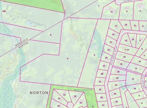
This exceptional 7.63-acre parcel presents a rare opportunity for industrial or commercial development in Norton, Massachusetts. Strategically located with significant frontage on Route 495 (688 feet) and South Washington Street (379 feet), this property offers unparalleled access and visibility. The site is zoned for industrial use, allowing for a wide range of development possibilities. Building plans can accommodate structures up to three stories high, with a maximum height of 50 feet, as permitted by right. The lot allows for a 33% coverage ratio, providing ample space for construction and potential future expansion. Given its size, location, and zoning, this land is ideal for a variety of industrial and commercial ventures, making it a highly attractive investment opportunity. The property's address is 260 South Washington Street, Norton, MA 02766, situated in Bristol County. Its precise coordinates are latitude 41.9628 and longitude -71.13607. This prime location offers easy access to major transportation routes, making it an excellent choice for businesses seeking convenient logistics and a strong presence in the region. The significant frontage on two major roadways ensures high visibility and accessibility for potential customers and employees. Don't miss this chance to acquire a substantial and well-positioned industrial land parcel.
Property profile
VerifiedCap rate & NOI
Location
Value estimations
Owner & transaction history
Comparables
6 recent transactions · within 1.5 miComparable in this City


Similar Nearby for Sale




Similar Nearby for Lease


Value estimation
Instant AI valuation built from comps, income signals, and proprietary benchmarks. A defensible range, not a single guess.
from $99/month
Cap rate
Cap rate calculated from real income and expense signals, benchmarked against sales of similar assets nearby.
from $99/month
Price sensitivity
The rate is the decision lever; valuation is the consequence.
Property tax & assessments
Tax year 2024Property description
Physical attributes from public recordsZoning & alternative use
Zoning
The recorded zoning designation, what the district officially allows, and the municipal source it comes from.
No zoning code is on file for this parcel. Zoning coverage grows with every catalog release — check back, or open Location Intelligence for use analysis of this corner.
Find the owner behind the property.
Unlock the evidence behind ownership: portfolio, transactions, debt and signals that help you decide who to contact next.
Registration is required before any owner information is shown.


