255 Walnut St Blacklick, OH 43004-9435
Property profile & analytics
255 Walnut St, Blacklick, OH 43004-9435
- Commercial land
- 1,440 SF
- 0.20 lot acres
Property ID
US66-0280781
The Realmo ID is a unique identifier assigned to every property, incorporating country codes and precise geo-coordinates for 300x300-foot land blocks. It enables standardized data collection and seamless integration of disparate sources such as ownership, tax, title data and physical specifications. By aggregating current and historical records, the Realmo ID powers advanced analytics and delivers deep, verifiable insights for real estate professionals.
Location Intelligence
Current Use by Public Records
- Commercial land
Property Details for 255 Walnut St
- Year built
- 1982
- Lot size
- 0.20 lot acres
- Property type
- Commercial land
- APN
- 170-000401
- APU
- 170000401
Sales History
| Date | Price | Buyer | Seller | Deed Type | Mortgage |
|---|---|---|---|---|---|
| Jun 9, 2021 | $85,000 | Scott Mueller | Kathleen M Weber | Warranty Deed | — |
| Dec 30, 2015 | — | Kathleen M Weber | — | Trustees Deed · related | $500k |
| Oct 14, 2014 | $23,800 | Kathleen M Weber | Weber Holdings-south LLC | Quit Claim Deed · related | — |
| Jul 21, 2005 | — | Weber Holdings-south LLC | Weber Holdings Ltd | Quit Claim Deed · related | — |
| Jun 4, 2001 | $67,000 | Weber Holdings Ltd | Mcmillan,donald F & Hilda A | Grant Deed · related | — |
| Aug 4, 1999 | — | Donald F Mcmillan | Blacklick Service Center INC | Grant Deed · related | — |
Value Estimations
based on Realmo’s proprietary methodology
-
AI approach
-
CAP approach
-
Comparable approach
-
Alternative Use
Get a detailed, property-specific estimation — fast and free
Location Insight
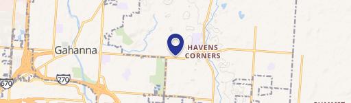
- Map
- Local Demand
- City
- Blacklick
- County
- Franklin
- State
- Ohio
- Longitude
- -82.8118
- Latitude
- 39.9956
- CBSA code
- 18140
- CBSA name
- COLUMBUS, OH METROPOLITAN STATISTICAL AREA
Property Tax & Assessments
Tax date
Tax Amount
Assessed Land Value
Assessed Improvement Value
Total Assessed Value
Applied Tax Rate
Land Market Value
Improvement Market Value
Total Market Value
2023
$2,484
$30,800
$0.00
$30,800
-
$88,000
$0.00
$88,000