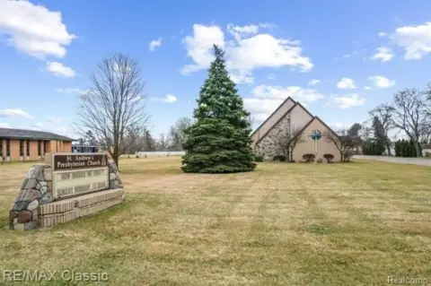
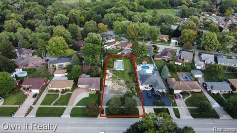
24634 Frd Rd Dearborn Heights, MI 48127-3111
Property profile & analytics
24634 Frd Rd, Dearborn Heights, MI 48127-3111
- Investment properties
- 1,808 SF
- 0.04 lot acres
Property ID
US43-1693085
The Realmo ID is a unique identifier assigned to every property, incorporating country codes and precise geo-coordinates for 300x300-foot land blocks. It enables standardized data collection and seamless integration of disparate sources such as ownership, tax, title data and physical specifications. By aggregating current and historical records, the Realmo ID powers advanced analytics and delivers deep, verifiable insights for real estate professionals.
Location Intelligence
Current Use by Public Records
- Investment properties
Property Details for 24634 Frd Rd
- Year built
- 1941
- Construction
- CONCRETE BLOCKS
- Lot size
- 0.04 lot acres
- Property type
- Investment properties
- Property subtype
- Live-work space
- APN
- 33 018 01 0103 000
- APU
- 33018010103000
Sales History
| Date | Price | Buyer | Seller | Deed Type | Mortgage |
|---|---|---|---|---|---|
| Jan 15, 2025 | $175,000 | Mosawi Magic LLC | Mohamad Ibrahim Akanan | Warranty Deed | — |
| Jan 18, 2018 | $145,000 | Mohamad I Akanan | Abdallah,mohamed | Warranty Deed | — |
| Jan 7, 2013 | $55,454 | Rose Acceptance INC | Deputy Sheriff Of Wayne County | Trustees Deed · related | — |
Value Estimations
based on Realmo’s proprietary methodology
-
AI approach
-
CAP approach
-
Comparable approach
-
Alternative Use
Get a detailed, property-specific estimation — fast and free
Location Insight
- Map
- Local Demand
- City
- Dearborn Heights
- County
- Wayne
- State
- Michigan
- Longitude
- -83.2793
- Latitude
- 42.3271
- CBSA code
- 19820
- CBSA name
- DETROIT-WARREN-LIVONIA, MI METROPOLITAN STATISTICAL AREA
Property Tax & Assessments
Tax date
Tax Amount
Assessed Land Value
Assessed Improvement Value
Total Assessed Value
Applied Tax Rate
Land Market Value
Improvement Market Value
Total Market Value
2023
$3,913
$0.00
$0.00
$65,600
-
$0.00
$0.00
$131,200