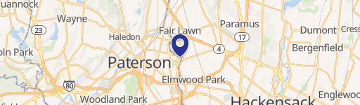
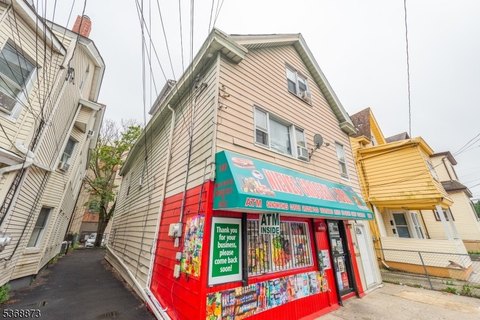
243 29th St Paterson, NJ 07514
I. MU Mixed Use District: The MU Mixed Use District is intended to permit a mixture of commercial and industrial uses in appropriate locations in accordance with the City's Master Plan. This district is intended to create an environment for effective integration and mutual support among the nonresidential activities and to promote more viable economic develo…
Cap rate
Implied · in-place · derived from last sale + estimated NOIValue
AI, CAP & Alternative Use estimations · Realmo proprietary blendProperty tax & assessments
Tax year 2023Comparables
6 recent transactions · within 1.5 miComparable in this City


Similar Nearby for Sale


Similar Nearby for Lease


Property description
Physical attributes from public recordsZoning & alternative use
MU · Paterson, NJI. MU Mixed Use District: The MU Mixed Use District is intended to permit a mixture of commercial and industrial uses in appropriate locations in accordance with the City's Master Plan. This district is intended to create an environment for effective integration and mutual support among the nonresidential activities and to promote more viable economic development and higher land values. Further development of residences is prohibited in this district to protect homes from the adverse effects of the light industrial and intensive commercial uses permitted in the district and to conserve the supply of land for such uses. J. I‐1 Light Industrial District: The intent of the I‐1 Light Industrial District is to provide for a wide variety of light manufacturing, fabricating, processing, wholesale, distribution and warehousing uses in a setting conducive to public health, economic stability and growth, and protection from blight and nonindustrial encroachment. The regulations are designed to permit operations in a clean and quiet manner and to protect adjacent district uses and industries within the district. Further development of residences is prohibited in this district to protect homes from the adverse effects of industries and to conserve the supply of industrial land for industrial uses. Further, in order to avoid bringing the general public into the district, to protect commercial establishments from the adverse effects of industry and to conserve the supply of land for industrial uses, most commercial uses are prohibited from the I‐1 District. K. I‐2 Heavy Industrial District: The intent of the I‐2 Heavy Industrial District is to provide land for more intense types of industrial and manufacturing uses excluding those with nuisance characteristics. While the mapping of this district unavoidably includes some residential buildings, future construction of dwellings in such districts is prohibited in order to protect homes from the adverse effects of industries and to conserve the supply of industrial land for industrial uses. Further, in order to avoid bringing the general public into the district and in order to protect commercial establishments from the adverse effects of industry, most commercial uses are prohibited from the I‐2 District. L. GFHD Great Fall Historic District: The intent of the GFHD Great Falls Historic District is to safeguard the heritage and history of the City of Paterson by preserving the cultural, social, economic, and architectural elements of this historic area of the City;
No recorded transactions found for this property.
Costs & Benchmarks
Operating expenses, capex projections, utility benchmarks, and submarket comparables — all in one view.
Risks
Flood, climate, environmental, title, and tenant-concentration risk — surfaced with mitigations and source citations.


