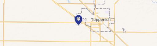
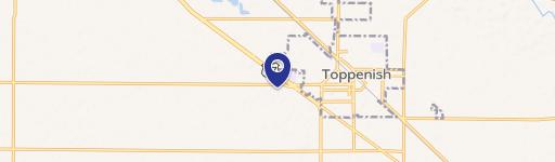
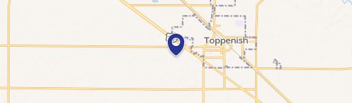
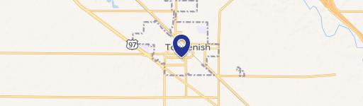
242 Ft Rd Toppenish, WA 98948-9756
Property profile & analytics
242 Ft Rd, Toppenish, WA 98948-9756
- Commercial land
- 1,220 SF
- 0.67 lot acres
Property ID
US90-1240013
The Realmo ID is a unique identifier assigned to every property, incorporating country codes and precise geo-coordinates for 300x300-foot land blocks. It enables standardized data collection and seamless integration of disparate sources such as ownership, tax, title data and physical specifications. By aggregating current and historical records, the Realmo ID powers advanced analytics and delivers deep, verifiable insights for real estate professionals.
Location Intelligence
Current Use by Public Records
- Commercial land
Property Details for 242 Ft Rd
- Year built
- 1950
- Lot size
- 0.67 lot acres
- Zone code
- M1
- Property type
- Commercial land
- APN
- 201009-22405
- APU
- 20100922405
Sales History
| Date | Price | Buyer | Seller | Deed Type | Mortgage |
|---|---|---|---|---|---|
| Jun 23, 2021 | — | Washington B Eef LLC | North Cascade Holdings LLC | Quit Claim Deed · related | — |
| Mar 30, 2012 | $250,000 | North Cascade Holdings LLC | Brownlee,linda | Warranty Deed | — |
| Jun 22, 2011 | — | County Of Yakima | Brownlee,guy W & Linda D | Warranty Deed | — |
| Aug 26, 1991 | $25,450 | Guy W Brownlee | Unknown | Grant Deed | — |
Value Estimations
based on Realmo’s proprietary methodology
-
AI approach
-
CAP approach
-
Comparable approach
-
Alternative Use
Get a detailed, property-specific estimation — fast and free
Location Insight
- Map
- Local Demand
- City
- Toppenish
- County
- Yakima
- State
- Washington
- Longitude
- -120.334
- Latitude
- 46.3745
- CBSA code
- 49420
- CBSA name
- YAKIMA, WA METROPOLITAN STATISTICAL AREA
Property Tax & Assessments
Tax date
Tax Amount
Assessed Land Value
Assessed Improvement Value
Total Assessed Value
Applied Tax Rate
Land Market Value
Improvement Market Value
Total Market Value
2024
$428
$43,800
$0.00
$43,800
-
$43,800
$0.00
$43,800