Back to Search
Property profile & analytics
FOR SALE
Apartment buildings
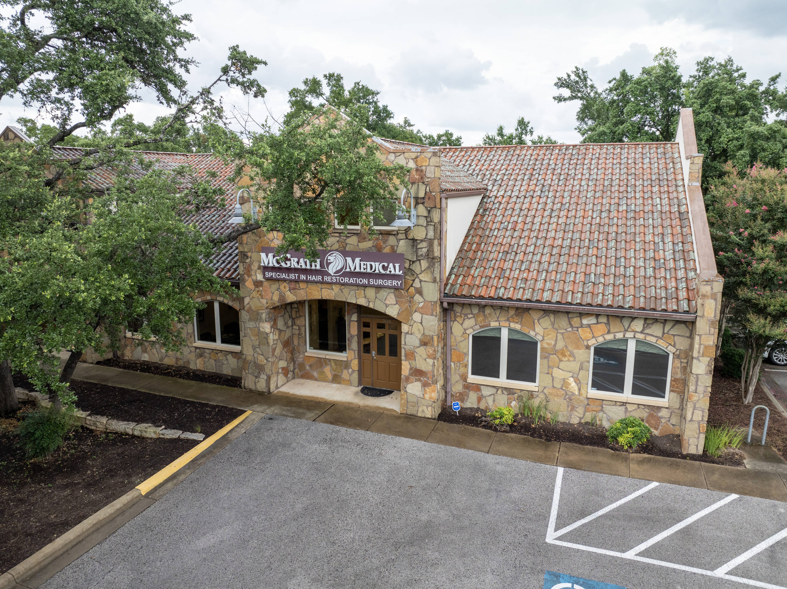
2500 W William Cannon Dr Austin, TX 78745
Entity Owned
Free & Clear
Property ID
US82-2649702
 For Sale
1 / 35
For Sale
1 / 35
$479,000
2500 W William Cannon Dr, Austin, TX 78745
View Listing →
Property profile
Verified
Property type
Apartment buildings
Use group
APARTMENT HOUSE (100+ UNITS)
Year built
2021
Total area
177,375 SF
Lot
26.2 ac (1,141,381 SF)
APN
423010147
UPID
US82-2649702
Cap rate & NOI
Priority signal for investors
Implied cap rate, NOI & suggested price
Cap rate vs submarket · NOI estimate · 3 price anchors
Implied cap rate, NOI & suggested price
Cap vs submarket · NOI estimate · 3 price anchors
Value estimations
Realmo proprietary · 4 methods
AI Approach
AI
$505k
CAP Approach
CAP
by Request
Comparable Approach
Comparable
$550k
Blend (final)
Blend
$530k
Owner & transaction history
Myers Riverwalk Investments LLC
Myers Riverwalk Investments LLC
since 2026
7 recorded transactions
Zoning & alternative use
Permitted uses
Permitted uses
Allowed · conditional · prohibited
Cap rate
Implied · in-place · derived from last sale + estimated NOI
Implied Cap rate
#1
Implied · in-place · NOI ÷ last sale
In-place · derived from last sale + estimated NOI
Cap rate, NOI & submarket benchmark
Implied cap rate vs Austin submarket · NOI estimate · Typical band, median & reading
Implied cap rate, NOI & submarket benchmark
Cap vs Austin submarket · NOI estimate · typical band, median & reading
Refine your cap rate
8-question underwriting flow
1.
Property current status — Going-In vs Stabilized
2.
Price for denominator — asking / offer / market
3.
Leasing status & lease structure (NNN / Gross)
4.
Tenant risk profile & vacancy assumption
5.
Upload T12 / rent roll / OM (optional)
Refine in 60 seconds, get exact suggested price
T12 upload · Submarket benchmarks · Sensitivity grid
Suggested price · 3 cap rate anchors
Income approach @ 5% / 7% / 9% — aggressive / typical / conservative
Suggested price at 5% / 7% / 9% cap
Aggressive / typical / conservative · Implied $/SF per anchor · Sensitivity grid
Suggested price at 5% / 7% / 9% cap
Aggressive / typical / conservative · implied $/SF · sensitivity
Value
AI, CAP & Alternative Use estimations · Realmo proprietary blendValue Estimations
Based on Realmo’s proprietary methodology
AI Approach
Method
Estimation
Statistic approach
by Request
ML approach
$505,000
CAP Approach
CAP Return
Estimation
6%
by Request
6.5%
by Request
7%
by Request
Alternative Use
Use
Estimation
APARTMENT HOUSE (5+ UNITS)
$510,000
Current use
Blend value · Realmo final
$530k
Range $477k – $583k · ±10%
Realmo estimate · informational only.
These numbers are calculated by our models from public records and may not reflect actual market value.
Not an appraisal.
Verify with a licensed appraiser before transacting. Realmo accepts no liability for divergence from real-world outcomes.
View the full estimation — every method, every assumption
Confidence drivers & risk notes · Custom comparable set · Free for first 3 / day
Full estimation methodology
Every method · every assumption · confidence drivers
Price per SF
Sale + rent benchmarks
Subject property
$3 / SF
Submarket sale & rent benchmarks
Median sale $/SF · Asking & closed rent · Submarket vacancy
Submarket sale & rent benchmarks
Median sale $/SF · asking & closed rent · submarket vacancy
Property tax & assessments
Tax year 2022Property tax & assessments
Tax year 2022
Assessed value
$33,941,991
Assessed 2023
Previous assessed
$33,941,991
+0.0% YoY
Assessed land
$2,693,659
Assessed improvement
$31,248,332
Land market value
$2,693,659
Improvement market value
$31,248,332
Total market value
$33,941,991
Applied tax rate
2.0000
Comparables
6 recent transactions · within 1.5 miComparable in this city
6 recent transactions
Comparable in this City


Similar Nearby for Sale


Similar Nearby for Lease


Recent comparable sales
Sale price & price/SF · Sale date & distance · Adjustments & confidence
Recent comparable sales
Sale price & $/SF · sale date & distance · adjustments
Property description
Physical attributes from public recordsBuilding & lot
Public records
Property type
Apartment buildings
Use group
APARTMENT HOUSE (100+ UNITS)
Status
For Sale
Year built
2021
Heating
NONE
Stories
1
Total area
177,375 SF
Lot
26.2 ac (1,141,381 SF)
APN
423010147
UPID
US82-2649702
Jurisdiction
TRAVIS
Zoning & alternative use
Zoning · permitted uses
Permitted & conditional uses
Allowed uses · Special-permit conditions · Prohibited uses
Permitted & conditional uses
Allowed · special-permit conditions · prohibited
Alternative use value scenarios
Repositioning upside vs current use
APARTMENT HOUSE (5+ UNITS) Current
Est. value
$510,000
APARTMENT HOUSE (5+ UNITS) Current
Alternative use deep dive — conversion cost, permits, timeline
Conversion cost estimate · Permit path & risks · Stabilized NOI per option
Alternative use deep dive
Conversion cost · permit path · stabilized NOI per option
Building & site characteristics
From public records
Year built
2021
Heating
NONE
Stories
1
Lot
26.2 ac
Current owner
From public records · entity-resolved
Myers Riverwalk Investments LLC
Entity
Free & Clear · 0 yrs held
Mailing address
1124 S INTERSTATE 35, AUSTIN, TX 78704-2614
Mailing matches property
Yes
Owner-occupied
Yes
Ownership since
2026
Owner contacts — direct phone, email, and related entities
Decision-maker phone · Verified email · Related entities & filings
Owner contacts
Email · phone · related entities
Sales History
31 recorded events · public records
Date
Price
Buyer
Seller
Deed Type
Mortgage
May 4, 2026
—
Myers Riverwalk Investments LLC
Drm Enterprises LLC
Special Warranty Deed
—
Apr 28, 2026
$1,130,500
Newport Advanced Solutions LLC
Skc Realty LLC
Deed
$850,000 · First Citizens Bank And Trust Company
Apr 20, 2026
$1,033,000
Kinzler Ventures LLC
Drm Enterprises LLC
Special Warranty Deed
$826,400 · Frost Bank
Jan 16, 2026
—
Jones Reyes Real Estaje Ventures Ll
—
Deed
related
$540,000 · Frost Bank
Aug 6, 2024
—
Newport Advanced Solutions LLC
Fahrenheit Realty LLC
Deed
$1,466,250 · First Citizens Bank & Trust Co
May 10, 2024
—
Luque Real Estate Holdings LLC
Oyster Creek Associate Pa
Deed
$357,000 · First Citizens Bank & Trust Co
Jul 21, 2023
—
Bonczek Enterprises LLC Series A
Drm Enterprises LLC
Warranty Deed
—
Feb 3, 2022
—
Smf2022 LLC
Ferrara Investments LP
Deed
$400,000 · Frost Bank
Jul 9, 2021
—
West Cannon Holdings LLC
Danforth Holdings Ltd
Deed
$5,000 · Vista Bank
Jul 1, 2021
—
Qiuxia Han
Zhigang Zhang
Quitclaim Deed
$405,500 · Jpmorgan Chase Bank NA
Jun 4, 2021
—
Samuel C Fotopoulos
Wm Cannon 303 LLC
Special Warranty Deed
—
Jul 22, 2020
—
Shames Family Trust
—
Deed
related
$750,000 · Business Bk/tx NA
Apr 27, 2020
—
Dream Jar LLC
—
Deed
related
$1,126,298 · First Citizens Bk
Dec 13, 2019
—
Housing Authority Of The City & Aus
Ldg Dev LLC
Grant Deed
related
$25,000 · Housing Auth
Oct 23, 2019
—
Ldg Dev LLC
—
Grant Deed
related
$1,167,000 · Citizens Union Bk
Apr 25, 2019
—
Rampage Law Ltd
—
Deed
related
$960,000 · Broadway Bk
Jan 31, 2019
—
Dream Jar LLC
—
Deed
related
$225,000 · First Citizens Bank & Trust Co
Nov 20, 2018
—
Sc South Austin LLC
Apa Stonegate Holdings LLC
Grant Deed
$1,000,000 · Affiliated Bk
Jun 26, 2018
—
Dream Jar LLC
—
Deed
related
$635,501 · First Citizens Bank & Trust Co
Apr 25, 2018
—
Siddhartha M Properties LLC
Divija Neurology Center Pa
Grant Deed
—
Apr 3, 2018
—
William Cannon 303 LLC
Rodgers,gary R & Patricia A
Warranty Deed
—
Jul 6, 2017
—
Skc Realty LLC
Childrenshealth Properties LLC
Grant Deed
—
Mar 14, 2017
—
First Leap Holdings LLC
—
Deed
related
$797,200 · Jpmorgan Chase Bank NA
Jan 26, 2017
—
Shames Family Trust
Osprey Land Dev LLC
Warranty Deed
$525,000 · Bank Of The Ozarks
Aug 22, 2016
—
Ldg Dev LLC
Lawrence,kirk
Trustees Deed
$1,950,000 · Citizens Union Bk
Aug 16, 2016
—
Fahrenheit Realty LLC
Cannon Stonegate Ventures LLC
Deed
$762,600 · Jpmorgan Chase Bank NA
Jul 22, 2016
—
Rampage Law Ltd
—
Deed
related
$435,076 · Broadway Bk
Jun 10, 2016
—
Dream Jar LLC
—
Deed
related
$315,000 · First Citizens Bank & Trust Co
Jun 7, 2016
—
Divija Neurology Center Pa
Drm Ents LLC
Warranty Deed
$186,915 · Branch Bk&tr
Oct 13, 2009
—
Pawmatch
Hartzer,donna
Grant Deed
related
—
—
—
Bridges At Canyon View LP
—
Deed Of Trust
related
$25,000 · Housing Auth
Coming soon
Costs & Benchmarks
Operating expenses, capex projections, utility benchmarks, and submarket comparables — all in one view.
Coming soon
Risks
Flood, climate, environmental, title, and tenant-concentration risk — surfaced with mitigations and source citations.
Try Rey
Ask anything about this address in plain English.
“Is 15.6% cap rate sustainable?” · “Best tenant mix for BU1?” · “What’s the redev upside?”
Full reports are paid
Unlock the full Property Analytics report
Start free for 7 days — no card required. Full owner contacts, all 4 valuations with methodology, refine flow, comparable adjustments, foot-traffic deep dive, export to PDF / CSV.


