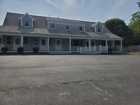
2360 State Hwy Eastham, MA 02642-2779
Property profile & analytics
2360 State Hwy, Eastham, MA 02642-2779
- Investment properties
- 1,980 SF
- 1.84 lot acres
Property ID
US38-1637882
The Realmo ID is a unique identifier assigned to every property, incorporating country codes and precise geo-coordinates for 300x300-foot land blocks. It enables standardized data collection and seamless integration of disparate sources such as ownership, tax, title data and physical specifications. By aggregating current and historical records, the Realmo ID powers advanced analytics and delivers deep, verifiable insights for real estate professionals.
Location Intelligence
Current Use by Public Records
- bp / Gas Station
- 7-Eleven / Grocery & Convenience Store
- Cardtronics ATM / Atm
- Western Union / Bank / Credit Union
Property Details for 2360 State Hwy
- Year built
- 1950
- Construction
- FRAME
- Lot size
- 1.84 lot acres
- Zone code
- CCNS
- Property type
- Investment properties
- Property subtype
- Live-work space
- APN
- EAST M:0015 L:0088
- APU
- EASTM0015L0088
Sales History
| Date | Price | Buyer | Seller | Deed Type | Mortgage |
|---|---|---|---|---|---|
| Apr 19, 2012 | $1 | Albert Thomas Dill Lt | Route 6 RT | Grant Deed · related | — |
Value Estimations
based on Realmo’s proprietary methodology
-
AI approach
-
CAP approach
-
Comparable approach
-
Alternative Use
Get a detailed, property-specific estimation — fast and free
Location Insight
- Map
- Local Demand
- City
- Eastham
- County
- Barnstable
- State
- Massachusetts
- Longitude
- -69.9718
- Latitude
- 41.8284
- CBSA code
- 12700
- CBSA name
- BARNSTABLE TOWN, MA METROPOLITAN STATISTICAL AREA
Property Tax & Assessments
Tax date
Tax Amount
Assessed Land Value
Assessed Improvement Value
Total Assessed Value
Applied Tax Rate
Land Market Value
Improvement Market Value
Total Market Value
2024
$7,523
$542,400
$530,800
$1,073,200
-
$0.00
$0.00
$0.00