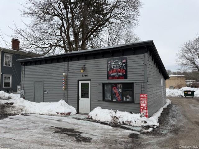
 For Sale
1 / 8
For Sale
1 / 8
Property summary
The property consists of a free-standing, one-story building located on Route 9D. It is positioned along a roadway reported to carry approximately 13,000 vehicles per day, directly in front of a bus stop and near a four-way corner light one building away. The site provides convenient access to Routes 9 and 84, and includes an adjacent lot identified by a separate tax ID (135689-6157-01-034604). The property is zoned for mixed use per the town, supporting potential development such as a multi-unit investment property.
Property profile
VerifiedCap rate & NOI
Location
Value estimations
Owner & transaction history
Value estimation
Instant AI valuation built from comps, income signals, and proprietary benchmarks. A defensible range, not a single guess.
from $99/month
Cap rate
Cap rate calculated from real income and expense signals, benchmarked against sales of similar assets nearby.
from $99/month
Price sensitivity
The rate is the decision lever; valuation is the consequence.
Property tax & assessments
Property description
Physical attributes from public recordsZoning & alternative use
Zoning
The recorded zoning designation, what the district officially allows, and the municipal source it comes from.
No zoning code is on file for this parcel. Zoning coverage grows with every catalog release — check back, or open Location Intelligence for use analysis of this corner.
Find the owner behind the property.
Unlock the evidence behind ownership: portfolio, transactions, debt and signals that help you decide who to contact next.
Registration is required before any owner information is shown.


