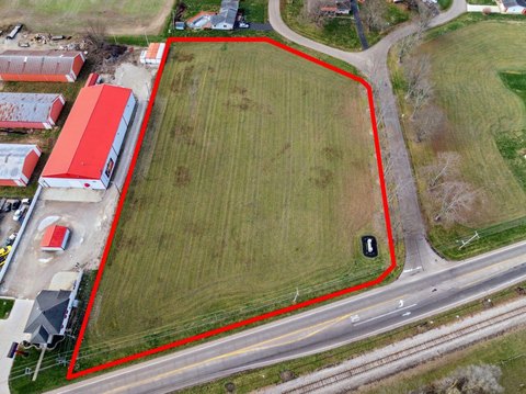
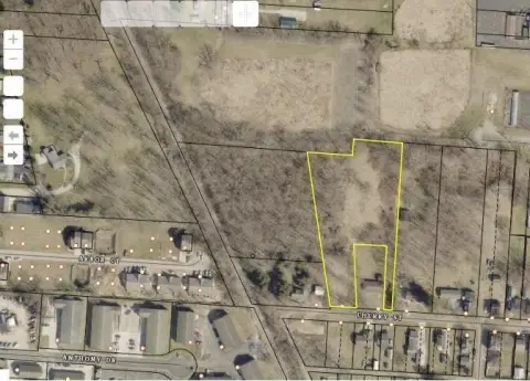
21st N St Newark, OH 43055
Property profile & analytics
21st N St, Newark, OH 43055
- Commercial land
- 4.63 lot acres
Property ID
US66-4588746
The Realmo ID is a unique identifier assigned to every property, incorporating country codes and precise geo-coordinates for 300x300-foot land blocks. It enables standardized data collection and seamless integration of disparate sources such as ownership, tax, title data and physical specifications. By aggregating current and historical records, the Realmo ID powers advanced analytics and delivers deep, verifiable insights for real estate professionals.
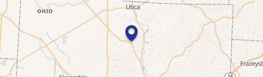
Location Intelligence
Current Use by Public Records
- Commercial land
Property Details for 21st N St
- Lot size
- 4.63 lot acres
- Property type
- Commercial land
- APN
- 054-286452-00.000
- APU
- 5428645200000
Sales History
| Date | Price | Buyer | Seller | Deed Type | Mortgage |
|---|---|---|---|---|---|
| Jun 27, 2024 | — | Gkc Lucas LLC | Linden Avenue LLC | Assignment Of Lease (leasehold Sale) | — |
| Jun 24, 2024 | $360,000 | Gkc Lucas LLC | James G Van Winkle | Deed | $1.5M · The Home Loan Savings Bank |
| Jun 24, 2024 | — | Dolgen Midwest LLC | Schultz Group LLC | Lease | — |
| Aug 27, 2019 | — | Van Winkle,james G Living Trust | Van Winkle,james | Quit Claim Deed · related | — |
Value Estimations
based on Realmo’s proprietary methodology
-
AI approach
-
CAP approach
-
Comparable approach
-
Alternative Use
Get a detailed, property-specific estimation — fast and free
Location Insight
- Map
- Local Demand
- City
- Newark
- County
- Licking
- State
- Ohio
- Longitude
- -82.4273
- Latitude
- 40.0948
- CBSA code
- 18140
- CBSA name
- COLUMBUS, OH METROPOLITAN STATISTICAL AREA
Property Tax & Assessments
Tax date
Tax Amount
Assessed Land Value
Assessed Improvement Value
Total Assessed Value
Applied Tax Rate
Land Market Value
Improvement Market Value
Total Market Value
2023
$9,988
$243,080
$0.00
$243,080
-
$694,500
$0.00
$694,500