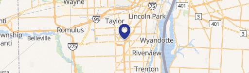
21721 Ecorse Rd Taylor, MI 48180-1846
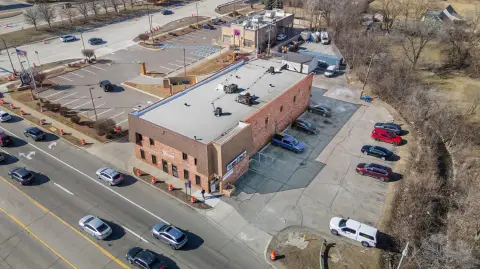
This exceptional 1,400 square foot commercial land parcel, located at 21721 Ecorse Road in Taylor, Michigan (zip code 48180), presents a unique investment opportunity. Situated in Wayne County, this property boasts a highly visible and accessible location within a busy commercial area. For over 40 years, this site housed the well-known Westborn Gun Shop, establishing a strong legacy within the community. The property offers ample parking, a significant advantage for any business. While no interior photos are available due to the previous tenant's nature of business, the building's prime location and established history make it an attractive prospect for a variety of commercial ventures. The asking price is $189,000. This is a chance to acquire a piece of Downriver history and capitalize on a well-established commercial location in a thriving neighborhood. The property is zoned for commercial use and offers significant potential for future development or continued operation as a commercial space. The property's geographic coordinates are latitude 42.2558325 and longitude -83.2481439. Serious inquiries are encouraged.
-
Westborn Gun Shop Gun Shop
Cap rate
Implied · in-place · derived from last sale + estimated NOIValue
AI, CAP & Alternative Use estimations · Realmo proprietary blendProperty tax & assessments
Tax year 2019Comparables
6 recent transactions · within 1.5 miComparable in this City


Similar Nearby for Sale


Similar Nearby for Lease


Property description
Physical attributes from public recordsZoning & alternative use
B-1 · Taylor, MITaylor. Always verify with local authorities before improvements.
Costs & Benchmarks
Operating expenses, capex projections, utility benchmarks, and submarket comparables — all in one view.
Risks
Flood, climate, environmental, title, and tenant-concentration risk — surfaced with mitigations and source citations.


