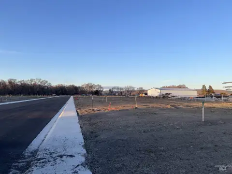
2090 7Th Ave Vale, OR 97918
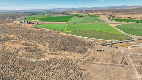
This expansive 523.67-acre agricultural property in Vale, Oregon, presents a significant investment opportunity. Located at 2090 7th Ave W and including a secondary structure at 4593 John Day Hwy, this land boasts a fully permitted feedlot with a capacity for 7000 head, as authorized by a CAFO permit. The property's irrigation system is robust, featuring five irrigation pivots supported by Vale Irrigation and supplemental water rights, ensuring consistent water supply. Further enhancing its utility, the property includes a substantial shop building with eight covered bays, ideal for equipment storage and maintenance. A 960-square-foot bunkhouse, situated at 4593 John Day Hwy, provides additional on-site accommodation. The property is being sold in its current "AS-IS" condition. The asking price for this exceptional agricultural holding is $3,500,000. Located in Malheur County, Oregon, with zip code 97918, this property offers significant potential for agricultural operations and related ventures. The property's two addresses are 2090 7th Ave W and 4593 John Day Hwy, both in Vale, Oregon.
Cap rate
Implied · in-place · derived from last sale + estimated NOIValue
AI, CAP & Alternative Use estimations · Realmo proprietary blendComparables
6 recent transactions · within 1.5 miComparable in this City


Similar Nearby for Sale
Property description
Physical attributes from public recordsZoning & alternative use
No recorded transactions found for this property.
Costs & Benchmarks
Operating expenses, capex projections, utility benchmarks, and submarket comparables — all in one view.
Risks
Flood, climate, environmental, title, and tenant-concentration risk — surfaced with mitigations and source citations.


