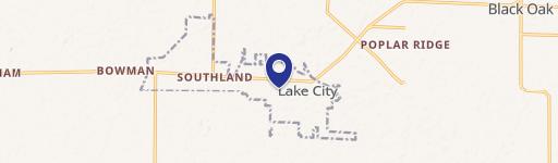
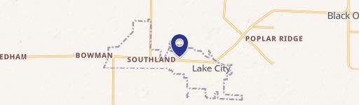
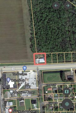
2010 Hwy 18 Lake City, AR 72437-8806
Property profile & analytics
2010 Hwy 18, Lake City, AR 72437-8806
- Retail space
- 7,500 SF
- 0.62 lot acres
Property ID
US05-1321297
The Realmo ID is a unique identifier assigned to every property, incorporating country codes and precise geo-coordinates for 300x300-foot land blocks. It enables standardized data collection and seamless integration of disparate sources such as ownership, tax, title data and physical specifications. By aggregating current and historical records, the Realmo ID powers advanced analytics and delivers deep, verifiable insights for real estate professionals.
Location Intelligence
Current Use by Public Records
- Retail space
Property Details for 2010 Hwy 18
- Year built
- 2003
- Lot size
- 0.62 lot acres
- Property type
- Retail space
- APN
- 07-146214-04000
- APU
- 714621404000
Sales History
| Date | Price | Buyer | Seller | Deed Type | Mortgage |
|---|---|---|---|---|---|
| Apr 7, 2025 | $20,617 | Paul Ong | State Ofarkansas | Deed · related | — |
| Oct 4, 2021 | $15,508 | Paul Ong | Commissioner Of State Lands | Redemption Deed · related | — |
| May 27, 2008 | — | Paul Ong | The Cynthia Choy Ong Living Trust | Intrafamily Transfer · related | — |
| Sep 12, 2006 | $335,000 | Cynthia Choy Ong | Lyles Enterprises INC | Warranty Deed | — |
Value Estimations
based on Realmo’s proprietary methodology
-
AI approach
-
CAP approach
-
Comparable approach
-
Alternative Use
Get a detailed, property-specific estimation — fast and free
Location Insight
- Map
- Local Demand
- City
- Lake City
- County
- Craighead
- State
- Arkansas
- Longitude
- -90.4541
- Latitude
- 35.8216
- CBSA code
- 27860
- CBSA name
- JONESBORO, AR METROPOLITAN STATISTICAL AREA
Property Tax & Assessments
Tax date
Tax Amount
Assessed Land Value
Assessed Improvement Value
Total Assessed Value
Applied Tax Rate
Land Market Value
Improvement Market Value
Total Market Value
2024
$3,802
$10,000
$64,908
$74,908
-
$50,000
$324,540
$374,540