20 Kenneth Miner Dr Wrentham, MA 02093-1168
Property profile & analytics
20 Kenneth Miner Dr, Wrentham, MA 02093-1168
- Industrial properties
- 9,686 SF
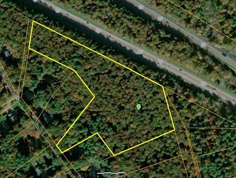
- 5.94 lot acres
Property ID
US38-1619214
The Realmo ID is a unique identifier assigned to every property, incorporating country codes and precise geo-coordinates for 300x300-foot land blocks. It enables standardized data collection and seamless integration of disparate sources such as ownership, tax, title data and physical specifications. By aggregating current and historical records, the Realmo ID powers advanced analytics and delivers deep, verifiable insights for real estate professionals.
Location Intelligence
Current Use by Public Records
- Industrial properties
Property Details for 20 Kenneth Miner Dr
- Year built
- 2008
- Construction
- STEEL FRAME
- Lot size
- 5.94 lot acres
- Zone code
- C-1 80
- Property type
- Industrial properties
- APN
- WREN M:O-13 B:03 L:03
- APU
- WRENMO13B03L03
Sales History
| Date | Price | Buyer | Seller | Deed Type | Mortgage |
|---|---|---|---|---|---|
| Jun 19, 2008 | $1 | Barbara Paullin | Capstan Hldgs 1 LLC | Grant Deed | — |
| Jun 19, 2008 | $500,000 | Greenn 1a LLC | Paullin,barbara | Grant Deed | $700k · Ben Franklin Savings Bank |
Value Estimations
based on Realmo’s proprietary methodology
-
Comparable approach
- Method
- Estimation
- Statistic Estimate
- $1,282,000
- AI Estimate
- $741,000
Market price range: $995k - $2.15MMarket price range: $366k - $1.47M -
Alternative Use
- Use
- Estimation
- INDUSTRIAL (GENERAL)
- $1,590,000 Current use
- WAREHOUSE, STORAGE
- $1,675,000 Change: +5% Conversion: Easy
Get a detailed, property-specific estimation — fast and free
Location Insight
- Map
- Local Demand
- City
- Wrentham
- County
- Norfolk
- State
- Massachusetts
- Longitude
- -71.3046
- Latitude
- 42.0835
- CBSA code
- 14460
- CBSA name
- BOSTON-CAMBRIDGE-QUINCY, MA-NH METROPOLITAN STATISTICAL AREA
Property Tax & Assessments
Tax date
Tax Amount
Assessed Land Value
Assessed Improvement Value
Total Assessed Value
Applied Tax Rate
Land Market Value
Improvement Market Value
Total Market Value
2024
$14,089
$344,800
$466,300
$811,100
-
$0.00
$0.00
$0.00