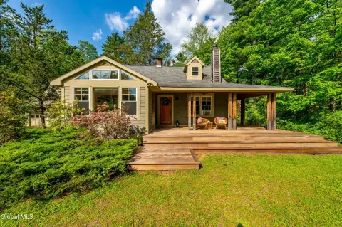
20 Comeau Dr, Unit 47 Woodstock, NY 12498-1466
Property profile & analytics
20 Comeau Dr, Unit 47, Woodstock, NY 12498-1466
- Office buildings
- 3,832 SF
- 75.20 lot acres
Property ID
US63-2124788
The Realmo ID is a unique identifier assigned to every property, incorporating country codes and precise geo-coordinates for 300x300-foot land blocks. It enables standardized data collection and seamless integration of disparate sources such as ownership, tax, title data and physical specifications. By aggregating current and historical records, the Realmo ID powers advanced analytics and delivers deep, verifiable insights for real estate professionals.
Location Intelligence
Current Use by Public Records
- Historical Society of Woodstock / Historical Society
- Lower Comeau Lot / Parking Lot & Garage
Property Details for 20 Comeau Dr
- Year built
- 1955
- Lot size
- 75.20 lot acres
- Zone code
- R5
- Property type
- Office buildings
- APN
- 515800 27.13-1-13.100
- APU
- 5158002713113100
Value Estimations
based on Realmo’s proprietary methodology
-
Comparable approach
- Method
- Estimation
- Statistic Estimate
- $757,000
- AI Estimate
- $611,000
Market price range: $340k - $757kMarket price range: $153k - $612k -
Alternative Use
- Use
- Estimation
- OFFICE BUILDING
- $520,000 Current use
- AUTO REPAIR, GARAGE
- $720,000 Change: +38% Conversion: Difficult
- COMMERCIAL (GENERAL)
- $650,000 Change: +24% Conversion: Easy
Get a detailed, property-specific estimation — fast and free
Location Insight
- Map
- Local Demand
- City
- Woodstock
- County
- Ulster
- State
- New York
- Longitude
- -74.1279
- Latitude
- 42.0382
- CBSA code
- 28740
- CBSA name
- KINGSTON, NY METROPOLITAN STATISTICAL AREA
Property Tax & Assessments
Tax date
Tax Amount
Assessed Land Value
Assessed Improvement Value
Total Assessed Value
Applied Tax Rate
Land Market Value
Improvement Market Value
Total Market Value
0
$0.00
$299,400
$661,600
$961,000
-
$643,871
$1,422,796
$2,066,667