1985 Hwy 49th E Ashland City, TN 37015-2534
Property profile & analytics
1985 Hwy 49th E, Ashland City, TN 37015-2534
- Commercial land
- 1,924 SF
- 6.63 lot acres
Property ID
US80-2024518
The Realmo ID is a unique identifier assigned to every property, incorporating country codes and precise geo-coordinates for 300x300-foot land blocks. It enables standardized data collection and seamless integration of disparate sources such as ownership, tax, title data and physical specifications. By aggregating current and historical records, the Realmo ID powers advanced analytics and delivers deep, verifiable insights for real estate professionals.
Location Intelligence
Current Use by Public Records
- Commercial land
Property Details for 1985 Hwy 49th E
- Year built
- 1955
- Lot size
- 6.63 lot acres
- Property type
- Commercial land
- APN
- 019 02800
- APU
- 1902800
Sales History
| Date | Price | Buyer | Seller | Deed Type | Mortgage |
|---|---|---|---|---|---|
| Mar 4, 2025 | — | Randal Pleasant View Partners LLC | — | Deed · related | $3.2M · Cb&s Bank INC |
| Dec 17, 2021 | $850,000 | Randal Pleasant View Partners LLC | Carl D Krantz | Warranty Deed | — |
| Nov 25, 2020 | $500,000 | Carl D Krantz | Dorothy S Tucker | Warranty Deed | — |
Value Estimations
based on Realmo’s proprietary methodology
-
AI approach
- Method
- Estimation
- Statistic approach
- $1,070,000
- ML approach
- $1,050,000
Get a detailed, property-specific estimation — fast and free
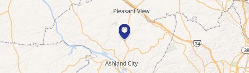
Location Insight
- Map
- Local Demand
- City
- Ashland City
- County
- Cheatham
- State
- Tennessee
- Longitude
- -87.046
- Latitude
- 36.3658
- CBSA code
- 34980
- CBSA name
- NASHVILLE-DAVIDSON--MURFREESBORO--FRANKLIN, TN METROPOLITAN STATISTICAL AREA
Property Tax & Assessments
Tax date
Tax Amount
Assessed Land Value
Assessed Improvement Value
Total Assessed Value
Applied Tax Rate
Land Market Value
Improvement Market Value
Total Market Value
2018
$1,427
$23,800
$0.00
$23,800
-
$59,500
$0.00
$59,500