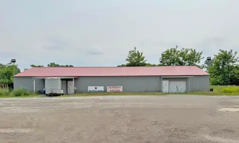
19475 Us Hwy 12 Edwardsburg, MI 49112-9264
Property profile & analytics
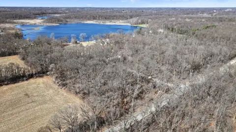
19475 Us Hwy 12, Edwardsburg, MI 49112-9264
- Industrial properties
- 6.67 lot acres
Property ID
US43-2654144
The Realmo ID is a unique identifier assigned to every property, incorporating country codes and precise geo-coordinates for 300x300-foot land blocks. It enables standardized data collection and seamless integration of disparate sources such as ownership, tax, title data and physical specifications. By aggregating current and historical records, the Realmo ID powers advanced analytics and delivers deep, verifiable insights for real estate professionals.
Location Intelligence
Current Use by Public Records
- Industrial properties
Property Details for 19475 Us Hwy 12
- Lot size
- 6.67 lot acres
- Property type
- Industrial properties
- APN
- 14-060-016-308-00
- APU
- 1406001630800
Sales History
| Date | Price | Buyer | Seller | Deed Type | Mortgage |
|---|---|---|---|---|---|
| Jul 26, 2024 | — | Land And Antlers LLC | Michael G Martyniuk | Land Contract | — |
| Mar 11, 2021 | $329,000 | Michael G Martyniuk | Michigan Properties LLC | Warranty Deed | — |
| Jul 15, 2011 | — | Michael Gregory Martyniuk | Mike Martyniuk | Intrafamily Transfer · related | — |
| Nov 22, 2006 | $329,000 | Mike Martyniuk | Michigan Properties LLC | Contract Sale | $319k · Michigan Properties LLC |
Value Estimations
based on Realmo’s proprietary methodology
-
AI approach
-
CAP approach
-
Comparable approach
-
Alternative Use
Get a detailed, property-specific estimation — fast and free
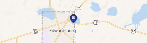
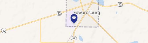
Location Insight
- Map
- Local Demand
- City
- Edwardsburg
- County
- Cass
- State
- Michigan
- Longitude
- -85.9448
- Latitude
- 41.7677
- CBSA code
- 43780
- CBSA name
- SOUTH BEND-MISHAWAKA, IN-MI METROPOLITAN STATISTICAL AREA
Property Tax & Assessments
Tax date
Tax Amount
Assessed Land Value
Assessed Improvement Value
Total Assessed Value
Applied Tax Rate
Land Market Value
Improvement Market Value
Total Market Value
2022
$6,251
$0.00
$0.00
$147,300
-
$0.00
$0.00
$294,600