1901 Highway 763 Columbia, MO 65202
Property profile & analytics
1901 Highway 763 Columbia, MO 65202
- Commercial land
- 600 SF
- 0.71 lot acres

Property ID
US48-0918033
The Realmo ID is a unique identifier assigned to every property, incorporating country codes and precise geo-coordinates for 300x300-foot land blocks. It enables standardized data collection and seamless integration of disparate sources such as ownership, tax, title data and physical specifications. By aggregating current and historical records, the Realmo ID powers advanced analytics and delivers deep, verifiable insights for real estate professionals.
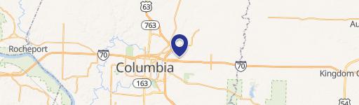
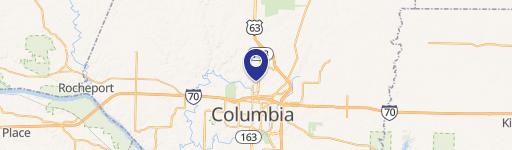
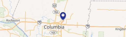
Location Intelligence
Current Use by Public Records
- Commercial land
Property Details for 1901 Highway 763
- Year built
- 1995
- Lot size
- 0.71 lot acres
- Property size
- 600 SF
- Zone code
- C3
- Property type
- Commercial land
- APN
- 16-308-00-00-011.00 01
- APU
- 1630800000110001
Description
This exceptional 0.71-acre commercial land parcel presents a unique investment opportunity in Columbia, Missouri. Located at 1901 Highway 763, this property boasts a highly desirable corner location at the signalized intersection of Range Line and Vandiver Roads, ensuring maximum visibility and accessibility. Its strategic positioning offers unparalleled exposure to the high volume of traffic on Interstate 70, a major thoroughfare. The site is zoned M-C, allowing for a variety of commercial uses. Access is readily available from both Range Line and Vandiver Roads, providing convenient ingress and egress for customers and employees. The asking price is $525,000, translating to approximately $739,437 per acre, reflecting the premium location and development potential. This property is perfectly suited for a quick-service restaurant (QSR) or other businesses that thrive on high traffic volume and excellent visibility. Don't miss this chance to acquire a prime commercial lot in a thriving Missouri market. The property is situated in Boone County, Missouri, with a zip code of 65202.
Value Estimations
based on Realmo’s proprietary methodology
-
AI approach
-
CAP approach
-
Comparable approach
-
Alternative Use
Get a detailed, property-specific estimation — fast and free
Location Insight
- Map
- Local Demand
- City
- Columbia
- County
- Boone
- State
- Missouri
- Longitude
- -92.3263
- Latitude
- 38.9714
- CBSA code
- 17860
- CBSA name
- COLUMBIA, MO METROPOLITAN STATISTICAL AREA
Property Tax & Assessments
Tax date
Tax Amount
Assessed Land Value
Assessed Improvement Value
Total Assessed Value
Applied Tax Rate
Land Market Value
Improvement Market Value
Total Market Value
2023
$0.00
$36,179
$0.00
$36,179
-
$113,060
$0.00
$113,060