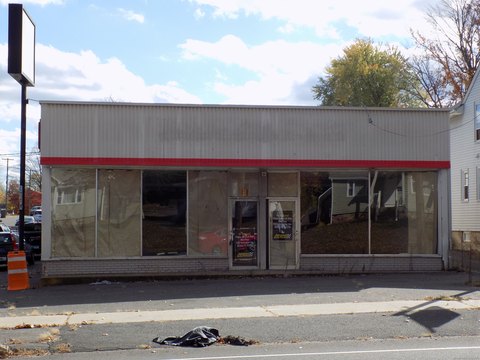
19 Stearns St Bristol, CT 06010-5130
Property profile & analytics
19 Stearns St Bristol, CT 06010-5130
- Showrooms
- 6,700 SF
- 0.52 lot acres
Property ID
US15-0328454
The Realmo ID is a unique identifier assigned to every property, incorporating country codes and precise geo-coordinates for 300x300-foot land blocks. It enables standardized data collection and seamless integration of disparate sources such as ownership, tax, title data and physical specifications. By aggregating current and historical records, the Realmo ID powers advanced analytics and delivers deep, verifiable insights for real estate professionals.
Location Intelligence
Current Use by Public Records
- The Salvation Army of Bristol / Food Bank / Charitable Organization
Property Details for 19 Stearns St
- Year built
- 1900
- Construction
- FRAME
- Lot size
- 0.52 lot acres
- Property size
- 6,700 SF
- Zone code
- R-15
- Property type
- Showrooms
- APN
- BRIS M:25 L:174
- APU
- BRISM25L174
Value Estimations
based on Realmo’s proprietary methodology
-
AI approach
- Method
- Estimation
- ML approach
- $360,000
-
Comparable approach
- Method
- Estimation
- Statistic Estimate
- $753,000
- AI Estimate
- $560,000
Market price range: $482k - $1.22MMarket price range: $321k - $934k -
Alternative Use
- Use
- Estimation
- COMMERCIAL (GENERAL)
- $815,000 Current use
- RETAIL STORES
- $770,000 Change: -5% Conversion: Easy
- OFFICE BUILDING
- $740,000 Change: -9% Conversion: Easy
- APARTMENT HOUSE (5+ UNITS)
- $700,000 Change: -14% Conversion: Moderate
- AUTO REPAIR, GARAGE
- $670,000 Change: -18% Conversion: Difficult
Get a detailed, property-specific estimation — fast and free
Location Insight
- Map
- Local Demand
- City
- Bristol
- County
- Hartford
- State
- Connecticut
- Longitude
- -72.9402
- Latitude
- 41.6791
- CBSA code
- 25540
- CBSA name
- HARTFORD-WEST HARTFORD-EAST HARTFORD, CT METROPOLITAN STATISTICAL AREA
Property Tax & Assessments
Tax date
Tax Amount
Assessed Land Value
Assessed Improvement Value
Total Assessed Value
Applied Tax Rate
Land Market Value
Improvement Market Value
Total Market Value
2023
$15,696
$92,820
$424,340
$517,160
-
$0.00
$0.00
$0.00