18719 Mac Arthur Dr North Little Rock, AR 72118
 For Lease
1 / 2
For Lease
1 / 2
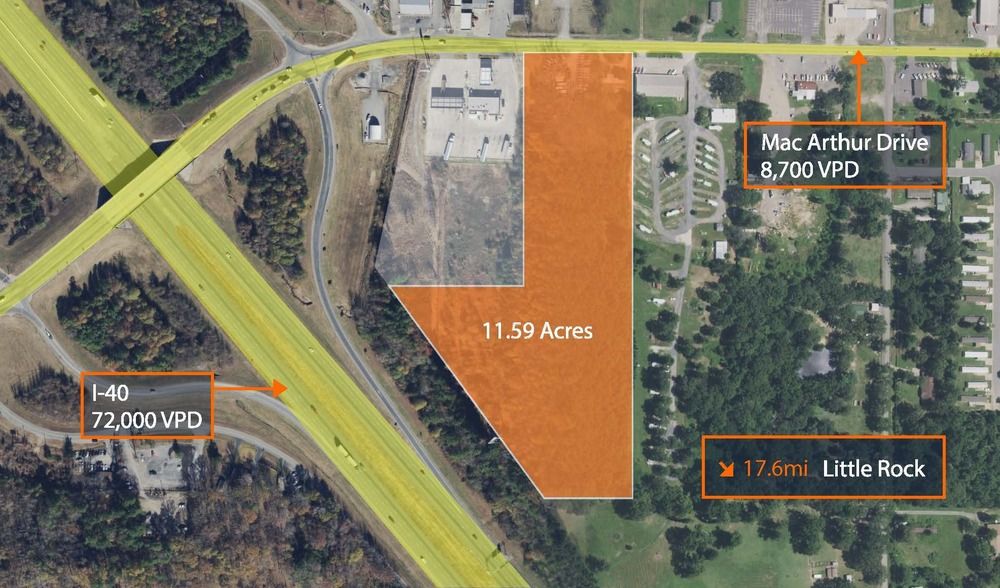
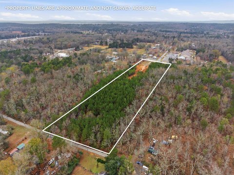
This exceptional 11.59-acre commercial land parcel presents a unique investment opportunity in the thriving LR - Maumelle Mayflower submarket of Pulaski County. Boasting a total land area of 521,335 square feet, this single-tenant property is ideally situated off MacArthur Drive, a high-traffic artery with 8,700 vehicles passing daily. The site's prominent location offers unparalleled visibility and accessibility, making it perfect for a variety of retail developments. The existing improvements consist of a 288 square foot building. This property is zoned for commercial use and presents significant potential for developers seeking a strategic location to capitalize on the area's robust growth and high consumer traffic. The expansive acreage allows for ample space for building construction, parking, and landscaping, ensuring a successful and impactful commercial venture. Serious inquiries are encouraged to explore the possibilities of this exceptional commercial land offering. The property is ready for immediate development, presenting a rare opportunity to establish a strong presence in a highly desirable location. This is a prime opportunity for businesses seeking high visibility and convenient access to a large customer base.
Cap rate
Implied · in-place · derived from last sale + estimated NOIValue
AI, CAP & Alternative Use estimations · Realmo proprietary blendComparables
6 recent transactions · within 1.5 miComparable in this City


Similar Nearby for Sale


Similar Nearby for Lease
Property description
Physical attributes from public recordsZoning & alternative use
No recorded transactions found for this property.
Costs & Benchmarks
Operating expenses, capex projections, utility benchmarks, and submarket comparables — all in one view.
Risks
Flood, climate, environmental, title, and tenant-concentration risk — surfaced with mitigations and source citations.


