1751 Riv Rd Paso Robles, CA 93446-7326
Property profile & analytics
1751 Riv Rd, Paso Robles, CA 93446-7326
- Mining land & claims
- 2.29 lot acres
Property ID
US10-3024650
The Realmo ID is a unique identifier assigned to every property, incorporating country codes and precise geo-coordinates for 300x300-foot land blocks. It enables standardized data collection and seamless integration of disparate sources such as ownership, tax, title data and physical specifications. By aggregating current and historical records, the Realmo ID powers advanced analytics and delivers deep, verifiable insights for real estate professionals.
Location Intelligence
Current Use by Public Records
- Mining land & claims
Property Details for 1751 Riv Rd
- Lot size
- 2.29 lot acres
- Zone code
- M
- Property type
- Mining land & claims
- APN
- 025-501-006
- APU
- 25501006
Sales History
| Date | Price | Buyer | Seller | Deed Type | Mortgage |
|---|---|---|---|---|---|
| Feb 10, 2006 | — | Troesh Ready Mix INC | Troesh,steve & Rene | Quit Claim Deed | — |
| Dec 30, 2002 | $750,000 | Steve Troesh | Stemper,tr | Grant Deed | $320k · Stemper Trust |
| Aug 27, 1999 | — | Stemper Trust | Stemper,gary E & Mary L | Quit Claim Deed · related | — |
Value Estimations
based on Realmo’s proprietary methodology
-
AI approach
-
CAP approach
-
Comparable approach
-
Alternative Use
Get a detailed, property-specific estimation — fast and free
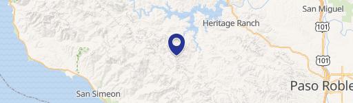
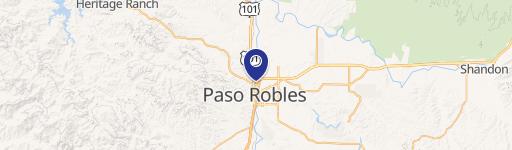
Location Insight
- Map
- Local Demand
- City
- Paso Robles
- County
- San Luis Obispo
- State
- California
- Longitude
- -120.684
- Latitude
- 35.6327
- CBSA code
- 42020
- CBSA name
- SAN LUIS OBISPO-PASO ROBLES, CA METROPOLITAN STATISTICAL AREA
Property Tax & Assessments
Tax date
Tax Amount
Assessed Land Value
Assessed Improvement Value
Total Assessed Value
Applied Tax Rate
Land Market Value
Improvement Market Value
Total Market Value
2024
$5,783
$520,200
$0.00
$520,200
-
$0.00
$0.00
$0.00