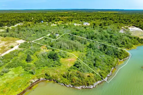
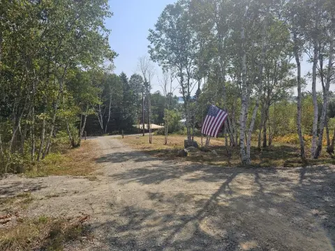
1720 Mason Bay Rd Jonesport, ME 04649-3017
Property profile & analytics
1720 Mason Bay Rd, Jonesport, ME 04649-3017
- Banks
- 1,568 SF
- 4.00 lot acres
Property ID
US42-0819455
The Realmo ID is a unique identifier assigned to every property, incorporating country codes and precise geo-coordinates for 300x300-foot land blocks. It enables standardized data collection and seamless integration of disparate sources such as ownership, tax, title data and physical specifications. By aggregating current and historical records, the Realmo ID powers advanced analytics and delivers deep, verifiable insights for real estate professionals.
Location Intelligence
Current Use by Public Records
- Banks
Property Details for 1720 Mason Bay Rd
- Year built
- 2000
- Construction
- CONCRETE
- Lot size
- 4.00 lot acres
- Zone code
- RA
- Property type
- Banks
- APN
- JNPT M:001 L:012
- APU
- JNPTM001L012
Sales History
| Date | Price | Buyer | Seller | Deed Type | Mortgage |
|---|---|---|---|---|---|
| Sep 1, 2022 | $202,350 | Robert W Ford | Us Bank NA Tr | Quit Claim Arm's Length For Ne States | $162k · Key Bank NA |
| Sep 24, 2021 | — | Us Bank NA Tr | Us Bank NA | Quit Claim Deed | — |
| Aug 2, 2021 | — | Us Bank NA Tr | Us Bank NA Tr | Quit Claim Deed | — |
Value Estimations
based on Realmo’s proprietary methodology
-
AI approach
-
CAP approach
-
Comparable approach
-
Alternative Use
Get a detailed, property-specific estimation — fast and free
Location Insight
- Map
- Local Demand
- City
- Jonesport
- County
- Washington
- State
- Maine
- Longitude
- -67.6077
- Latitude
- 44.6178
Property Tax & Assessments
Tax date
Tax Amount
Assessed Land Value
Assessed Improvement Value
Total Assessed Value
Applied Tax Rate
Land Market Value
Improvement Market Value
Total Market Value
2022
$2,361
$34,200
$104,700
$138,900
-
$0.00
$0.00
$0.00