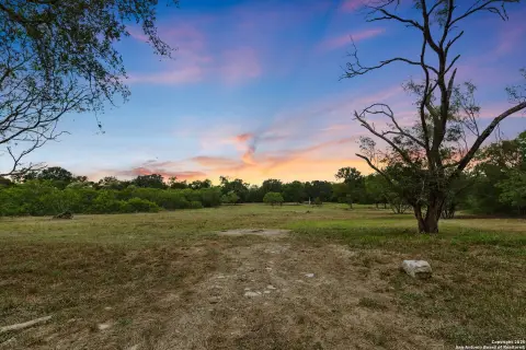
1522 State Hwy 21st W Cedar Creek, TX 78612-4839
Property profile & analytics
1522 State Hwy 21st W, Cedar Creek, TX 78612-4839
- Commercial real estate
- 6,928 SF
- 1.79 lot acres
Property ID
US82-5962151
The Realmo ID is a unique identifier assigned to every property, incorporating country codes and precise geo-coordinates for 300x300-foot land blocks. It enables standardized data collection and seamless integration of disparate sources such as ownership, tax, title data and physical specifications. By aggregating current and historical records, the Realmo ID powers advanced analytics and delivers deep, verifiable insights for real estate professionals.
Location Intelligence
Current Use by Public Records
- Commercial real estate
Property Details for 1522 State Hwy 21st W
- Year built
- 2013
- Lot size
- 1.79 lot acres
- Property type
- Commercial real estate
- APN
- R64113
- APU
- R64113
Sales History
| Date | Price | Buyer | Seller | Deed Type | Mortgage |
|---|---|---|---|---|---|
| Aug 4, 2022 | — | Heritage Oaks Gas Station LLC | — | Deed · related | $596k · Austin Telco FCU |
| May 13, 2014 | $832,000 | Heritage Oaks Gas Station LLC | Reddy Business Solutions INC | Venders Lien | $832k · Austin Telco FCU |
| Apr 20, 2010 | — | Reddy Business Solutions INC | Vasu Mekala | Special Warranty Deed | — |
| Oct 2, 2007 | — | Vasu Mekala | Ramzi Awad | Venders Lien | $80k · First National Bank Of Giddings |
| Sep 26, 2006 | — | Ramzi Awad | Philip Horst | Venders Lien | $570k · First National Bank Of Giddings |
Value Estimations
based on Realmo’s proprietary methodology
-
AI approach
-
CAP approach
-
Comparable approach
-
Alternative Use
Get a detailed, property-specific estimation — fast and free
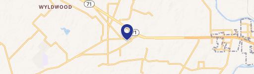
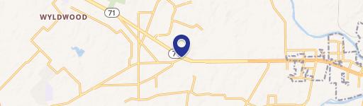
Location Insight
- Map
- Local Demand
- City
- Cedar Creek
- County
- Bastrop
- State
- Texas
- Longitude
- -97.528
- Latitude
- 30.0856
- CBSA code
- 12420
- CBSA name
- AUSTIN-ROUND ROCK, TX METROPOLITAN STATISTICAL AREA
Property Tax & Assessments
Tax date
Tax Amount
Assessed Land Value
Assessed Improvement Value
Total Assessed Value
Applied Tax Rate
Land Market Value
Improvement Market Value
Total Market Value
2023
$191
$366,469
$341,587
$708,056
-
$366,469
$341,587
$708,056