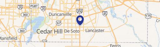
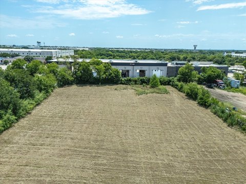
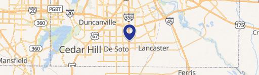
1462 Interstate 35th E Lancaster, TX 75134-2602
Property profile & analytics
1462 Interstate 35th E, Lancaster, TX 75134-2602
- Gas stations
- 3,750 SF
- 0.73 lot acres
Property ID
US82-5308592
The Realmo ID is a unique identifier assigned to every property, incorporating country codes and precise geo-coordinates for 300x300-foot land blocks. It enables standardized data collection and seamless integration of disparate sources such as ownership, tax, title data and physical specifications. By aggregating current and historical records, the Realmo ID powers advanced analytics and delivers deep, verifiable insights for real estate professionals.
Location Intelligence
Current Use by Public Records
- Gas stations
Property Details for 1462 Interstate 35th E
- Year built
- 1987
- Construction
- TILT-UP CONCRETE
- Lot size
- 0.73 lot acres
- Zone code
- Z39
- Property type
- Gas stations
- APN
- 360025000A11R0000
- APU
- 360025000A11R0000
Sales History
| Date | Price | Buyer | Seller | Deed Type | Mortgage |
|---|---|---|---|---|---|
| Dec 27, 2023 | — | Aslam Property INC | Alaa Aljabri | Deed | $368k · Bank Of Desoto NA |
| Feb 14, 2022 | — | Alaa Aljabri | Hobart Ambuehl | Deed | $357k · Bank Of Desoto NA |
| Jun 19, 2008 | — | Hobart Ambuehl | Patterson,mary L | Warranty Deed · related | — |
Value Estimations
based on Realmo’s proprietary methodology
-
AI approach
-
CAP approach
-
Comparable approach
-
Alternative Use
Get a detailed, property-specific estimation — fast and free
Location Insight
- Map
- Local Demand
- City
- Lancaster
- County
- Dallas
- State
- Texas
- Longitude
- -96.8214
- Latitude
- 32.6064
- CBSA code
- 19100
- CBSA name
- DALLAS-FORT WORTH-ARLINGTON, TX METROPOLITAN STATISTICAL AREA
Property Tax & Assessments
Tax date
Tax Amount
Assessed Land Value
Assessed Improvement Value
Total Assessed Value
Applied Tax Rate
Land Market Value
Improvement Market Value
Total Market Value
2023
$10,272
$63,600
$362,450
$426,050
-
$63,600
$362,450
$426,050