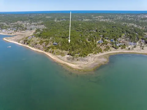
1446 State Hwy Rte 6th 6 Wellfleet, MA 02667-8701
Property profile & analytics
1446 State Hwy Rte 6th 6, Wellfleet, MA 02667-8701
- Retail space
- 4,982 SF
- 1.10 lot acres
Property ID
US38-0743869
The Realmo ID is a unique identifier assigned to every property, incorporating country codes and precise geo-coordinates for 300x300-foot land blocks. It enables standardized data collection and seamless integration of disparate sources such as ownership, tax, title data and physical specifications. By aggregating current and historical records, the Realmo ID powers advanced analytics and delivers deep, verifiable insights for real estate professionals.
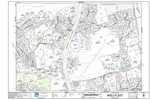
Location Intelligence
Current Use by Public Records
- Retail space
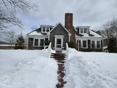
Property Details for 1446 State Hwy Rte 6th 6
- Year built
- 1930
- Construction
- FRAME
- Lot size
- 1.10 lot acres
- Zone code
- R30
- Property type
- Retail space
- APN
- WELL M:030.0 B:0006 L:0000.0
- APU
- WELLM0300B0006L00000
Sales History
| Date | Price | Buyer | Seller | Deed Type | Mortgage |
|---|---|---|---|---|---|
| Jul 3, 2014 | — | Parent,gerald S & Audrey S | — | Grant Deed · related | $1.2M · Seamens Svgs Bk |
| Mar 27, 2008 | $600,000 | Andrew K Parent | Audrey S Parent | Deed · related | $650k · Td Banknorth Mtg Grp |
| Apr 27, 2004 | — | Audrey S Parent | — | Deed Of Trust · related | $1.2M · Seamens Savings Bank |
| Apr 28, 1999 | $410,000 | Gerald E Parent | Seiser,michael J | Grant Deed | $225k · Seamens Savings Bank |
| Apr 28, 1999 | — | Gerald E Parent | — | Deed Of Trust · related | $360k · Seamens Savings Bank |
| Jan 16, 1996 | $175,000 | Michael J Seiser | Emily G Houghton Ret | Grant Deed | $200k · Thomas M Sykes |
| Jan 16, 1996 | — | Michael J Seiser | — | Deed Of Trust · related | $50k · Thomas M Sykes |
| May 9, 1990 | $500,000 | Gerald E Parent | Sentry Federal Sb | Grant Deed | $350k · Sentry Fed Svgs Bk |
| Feb 15, 1990 | $655,000 | Sentry Federal Sb | Blakely,george W | Grant Deed | — |
Value Estimations
based on Realmo’s proprietary methodology
-
Comparable approach
- Method
- Estimation
- Statistic Estimate
- $845,000
Market price range: $623k - $1.70M -
Alternative Use
- Use
- Estimation
- RETAIL STORES
- $1,125,000 Current use
- OFFICE BUILDING
- $1,120,000 Change: -0% Conversion: Easy
Get a detailed, property-specific estimation — fast and free
Location Insight
- Map
- Local Demand
- City
- Wellfleet
- County
- Barnstable
- State
- Massachusetts
- Longitude
- -69.9887
- Latitude
- 41.9165
- CBSA code
- 12700
- CBSA name
- BARNSTABLE TOWN, MA METROPOLITAN STATISTICAL AREA
Property Tax & Assessments
Tax date
Tax Amount
Assessed Land Value
Assessed Improvement Value
Total Assessed Value
Applied Tax Rate
Land Market Value
Improvement Market Value
Total Market Value
2024
$4,678
$357,100
$370,400
$727,500
-
$0.00
$0.00
$0.00