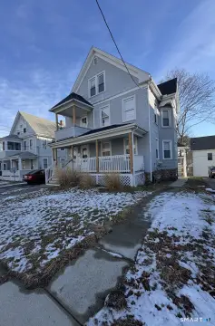
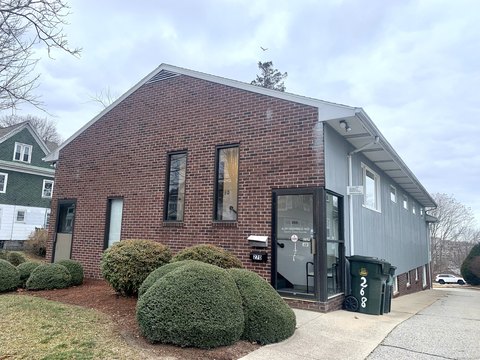
142 Montauk Ave New London, CT 06320-4849
Property profile & analytics
142 Montauk Ave, New London, CT 06320-4849
- Residential income homes
- 3,495 SF
- 0.17 lot acres
Property ID
US15-0285196
The Realmo ID is a unique identifier assigned to every property, incorporating country codes and precise geo-coordinates for 300x300-foot land blocks. It enables standardized data collection and seamless integration of disparate sources such as ownership, tax, title data and physical specifications. By aggregating current and historical records, the Realmo ID powers advanced analytics and delivers deep, verifiable insights for real estate professionals.
Location Intelligence
Current Use by Public Records
- Residential income homes
Property Details for 142 Montauk Ave
- Year built
- 1920
- Lot size
- 0.17 lot acres
- Property type
- Residential income homes
- Property subtype
- Small apartment buildings
- APN
- NLON M:E16 B:0113 L:0046
- APU
- NLONME16B0113L0046
Sales History
| Date | Price | Buyer | Seller | Deed Type | Mortgage |
|---|---|---|---|---|---|
| Nov 22, 2017 | — | Besade Realty LLC | Besade,stephen A | Quit Claim Deed · related | — |
| Jul 31, 2003 | — | Stephen A Besade | — | Deed Of Trust · related | $120k · Suntrust Mortgage INC |
| Dec 31, 1997 | $93,500 | Stephen A Besade | Gray,david P | Warranty Deed | $75k · Accubanc Mortgage Corp |
Value Estimations
based on Realmo’s proprietary methodology
-
AI approach
-
CAP approach
-
Comparable approach
-
Alternative Use
Get a detailed, property-specific estimation — fast and free
Location Insight
- Map
- Local Demand
- City
- New London
- County
- New London
- State
- Connecticut
- Longitude
- -72.1046
- Latitude
- 41.3443
- CBSA code
- 35980
- CBSA name
- NORWICH-NEW LONDON, CT METROPOLITAN STATISTICAL AREA
Property Tax & Assessments
Tax date
Tax Amount
Assessed Land Value
Assessed Improvement Value
Total Assessed Value
Applied Tax Rate
Land Market Value
Improvement Market Value
Total Market Value
2023
$4,963
$33,040
$100,240
$133,280
-
$0.00
$0.00
$0.00