14 Graf Rd Newburyport, MA 01950-4099
Property profile & analytics
14 Graf Rd, Newburyport, MA 01950-4099
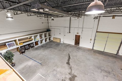
- Industrial properties
- 9,140 SF
- 3.70 lot acres
Property ID
US38-0367518
The Realmo ID is a unique identifier assigned to every property, incorporating country codes and precise geo-coordinates for 300x300-foot land blocks. It enables standardized data collection and seamless integration of disparate sources such as ownership, tax, title data and physical specifications. By aggregating current and historical records, the Realmo ID powers advanced analytics and delivers deep, verifiable insights for real estate professionals.
Location Intelligence
Current Use by Public Records
- Industrial properties
Property Details for 14 Graf Rd
- Year built
- 1960
- Construction
- MASONRY/CONCRETE MASONRY UNITS (CMUS)
- Lot size
- 3.70 lot acres
- Property type
- Industrial properties
- APN
- NEWP M:0082 B:0003A L:0000
- APU
- NEWPM0082B0003AL0000
Sales History
| Date | Price | Buyer | Seller | Deed Type | Mortgage |
|---|---|---|---|---|---|
| Jun 29, 2022 | — | Hollis RT | — | Deed · related | $700k · Eastern Bank |
| Sep 27, 2016 | — | Hollis RT | — | Deed · related | $1.8M · Eastern Bank |
| Dec 5, 2014 | $1,200,000 | Hollis RT | Newbury Partners Ma LP | Quit Claim Arm's Length For Ne States | $1.1M · Reading Cooperative Bank |
| Feb 3, 2006 | — | Hiller RT | — | Deed Of Trust · related | $300k · Brookline Savings Bank |
| Jul 27, 1989 | — | Newbury Partners | — | Deed Of Trust · related | $77k · Zuckerman Family Nomi |
Value Estimations
based on Realmo’s proprietary methodology
-
CAP approach
- CAP Return
- Estimation
- 6%
- $1,620,000
- 6.5%
- $1,495,000
- 7%
- $1,390,000
-
Comparable approach
- Method
- Estimation
- AI Estimate
- $1,757,000
Market price range: $487k - $1.87M -
Alternative Use
- Use
- Estimation
- INDUSTRIAL (GENERAL)
- $2,095,000 Current use
- AUTO REPAIR, GARAGE
- $2,190,000 Change: +4% Conversion: Easy
- RETAIL STORES
- $2,035,000 Change: -3% Conversion: Moderate
Get a detailed, property-specific estimation — fast and free
Location Insight
- Map
- Local Demand
- City
- Newburyport
- County
- Essex
- State
- Massachusetts
- Longitude
- -70.8843
- Latitude
- 42.8042
- CBSA code
- 14460
- CBSA name
- BOSTON-CAMBRIDGE-QUINCY, MA-NH METROPOLITAN STATISTICAL AREA
Property Tax & Assessments
Tax date
Tax Amount
Assessed Land Value
Assessed Improvement Value
Total Assessed Value
Applied Tax Rate
Land Market Value
Improvement Market Value
Total Market Value
2024
$16,836
$739,200
$949,500
$1,688,700
-
$0.00
$0.00
$0.00