139 Upas Rd Brewster, MA 02631
Property profile & analytics
139 Upas Rd, Brewster, MA 02631
- Manufacturing properties
- 4,294 SF
- 0.49 lot acres
Property ID
US38-0693361
The Realmo ID is a unique identifier assigned to every property, incorporating country codes and precise geo-coordinates for 300x300-foot land blocks. It enables standardized data collection and seamless integration of disparate sources such as ownership, tax, title data and physical specifications. By aggregating current and historical records, the Realmo ID powers advanced analytics and delivers deep, verifiable insights for real estate professionals.
Location Intelligence
Current Use by Public Records
- RSP Welding Fabrication & Repair / General Contractor
- Brian P Daley Construction Inc / Construction Company / General Contractor
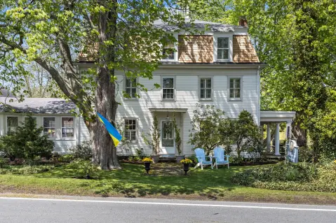
Property Details for 139 Upas Rd
- Year built
- 1976
- Construction
- MASONRY/CONCRETE MASONRY UNITS (CMUS)
- Lot size
- 0.49 lot acres
- Zone code
- COMM H
- Property type
- Manufacturing properties
- APN
- BREW M:77 B:17
- APU
- BREWM77B17
Sales History
| Date | Price | Buyer | Seller | Deed Type | Mortgage |
|---|---|---|---|---|---|
| Jul 29, 2022 | $430,000 | Hook&hammer LLC | Raymond M Parks | Quit Claim Arm's Length For Ne States | $344k · Eastern Bank |
| Jan 18, 2019 | — | Raymond M Parks | Underpass Road | Quit Claim Deed · related | — |
| Aug 27, 2003 | $260,000 | Underpass Road RT | Eldredge,steven W | Grant Deed | $260k · Zenon Grzybowski |
| Feb 24, 1988 | — | Underpass Rd Rlty Tr | — | Deed Of Trust · related | $420k · Metrowest Bank |
Value Estimations
based on Realmo’s proprietary methodology
-
AI approach
-
CAP approach
-
Comparable approach
-
Alternative Use
Get a detailed, property-specific estimation — fast and free
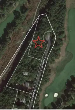
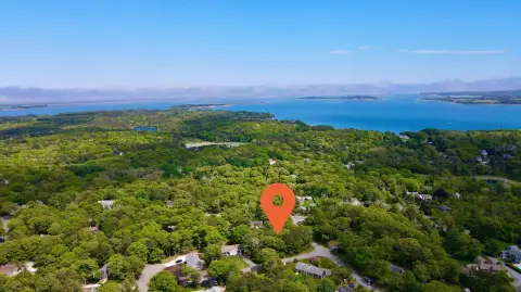
Location Insight
- Map
- Local Demand
- City
- Brewster
- County
- Barnstable
- State
- Massachusetts
- Longitude
- -70.0658
- Latitude
- 41.7623
- CBSA code
- 12700
- CBSA name
- BARNSTABLE TOWN, MA METROPOLITAN STATISTICAL AREA
Property Tax & Assessments
Tax date
Tax Amount
Assessed Land Value
Assessed Improvement Value
Total Assessed Value
Applied Tax Rate
Land Market Value
Improvement Market Value
Total Market Value
2024
$2,439
$208,000
$150,100
$358,100
-
$0.00
$0.00
$0.00