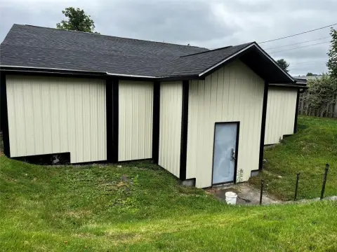
13675 Rte 6th 6 Corry, PA 16407-8916
Property profile & analytics
13675 Rte 6th 6, Corry, PA 16407-8916
- Warehouses
- 6,114 SF
- 1.50 lot acres
Property ID
US73-1652163
The Realmo ID is a unique identifier assigned to every property, incorporating country codes and precise geo-coordinates for 300x300-foot land blocks. It enables standardized data collection and seamless integration of disparate sources such as ownership, tax, title data and physical specifications. By aggregating current and historical records, the Realmo ID powers advanced analytics and delivers deep, verifiable insights for real estate professionals.
Location Intelligence
Current Use by Public Records
- Warehouses
Property Details for 13675 Rte 6th 6
- Year built
- 1971
- Construction
- WOOD
- Lot size
- 1.50 lot acres
- Zone code
- R2
- Property type
- Warehouses
- APN
- 49-016-033.0-013.00
- APU
- 49016033001300
Sales History
| Date | Price | Buyer | Seller | Deed Type | Mortgage |
|---|---|---|---|---|---|
| Nov 6, 2020 | $225,000 | David N Alexander | Wayco Investment Company | Warranty Deed | $148k · Citizens Bank |
| Dec 31, 2008 | $59,435 | Wayco Investment Co | Hammond,w W JR & Mary A | Grant Deed | — |
| Dec 31, 2008 | $20,231 | Wayco Investment Co | Wayne Investment Co INC | Grant Deed | — |
| Dec 30, 2004 | — | William W Hammond JR. | Hammond,william W JR & Mary A | Quit Claim Deed · related | — |
Value Estimations
based on Realmo’s proprietary methodology
-
AI approach
-
CAP approach
-
Comparable approach
-
Alternative Use
Get a detailed, property-specific estimation — fast and free
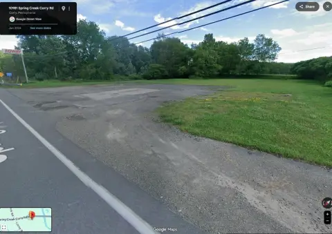
Location Insight
- Map
- Local Demand
- City
- Corry
- County
- Erie
- State
- Pennsylvania
- Longitude
- -79.6603
- Latitude
- 41.9335
- CBSA code
- 21500
- CBSA name
- ERIE, PA METROPOLITAN STATISTICAL AREA
Property Tax & Assessments
Tax date
Tax Amount
Assessed Land Value
Assessed Improvement Value
Total Assessed Value
Applied Tax Rate
Land Market Value
Improvement Market Value
Total Market Value
2023
$3,478
$30,000
$120,400
$150,400
-
$30,000
$120,400
$150,400