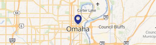
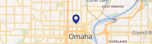
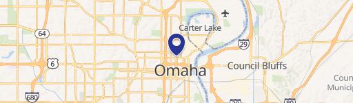
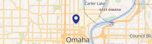
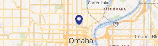
1311 Howard St Omaha, NE 68102-2820
Property profile & analytics
1311 Howard St Omaha, NE 68102-2820
- Manufacturing properties
- 31,125 SF
- 0.26 lot acres
Property ID
US57-0194461
The Realmo ID is a unique identifier assigned to every property, incorporating country codes and precise geo-coordinates for 300x300-foot land blocks. It enables standardized data collection and seamless integration of disparate sources such as ownership, tax, title data and physical specifications. By aggregating current and historical records, the Realmo ID powers advanced analytics and delivers deep, verifiable insights for real estate professionals.
Location Intelligence
Current Use by Public Records
- J.P. Cooke Company / (Bike/Boat/Book/etc) Store
- Revolve Palm / Financial Advisor / Insurance Agency
Property Details for 1311 Howard St
- Year built
- 1889
- Lot size
- 0.26 lot acres
- Property size
- 31,125 SF
- Property type
- Manufacturing properties
- APN
- 315530003
- APU
- 315530003
Value Estimations
based on Realmo’s proprietary methodology
-
Alternative Use
- Use
- Estimation
- INDUSTRIAL (GENERAL)
- $2,800,000 Current use
Get a detailed, property-specific estimation — fast and free
Location Insight
- Map
- Local Demand
- City
- Omaha
- County
- Douglas
- State
- Nebraska
- Longitude
- -95.9339
- Latitude
- 41.2552
- CBSA code
- 36540
- CBSA name
- OMAHA-COUNCIL BLUFFS, NE-IA METROPOLITAN STATISTICAL AREA
Property Tax & Assessments
Tax date
Tax Amount
Assessed Land Value
Assessed Improvement Value
Total Assessed Value
Applied Tax Rate
Land Market Value
Improvement Market Value
Total Market Value
2022
$0.00
$0.00
$0.00
$0.00
-
$0.00
$0.00
$0.00