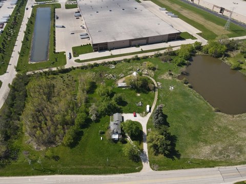
12355 Uline Way Kenosha, WI 53144-1100
3.27 C-2 LOWLAND RESOURCE CONSERVANCY DISTRICT Primary Purpose and Characteristics. The C-2 Lowland Resource Conservancy District is intended to be used to prevent destruction of valuable natural or man made resources and to protect water courses and marshes including the shorelands of navigable waters, and areas that are not naturally drained, or which are…
Cap rate
Implied · in-place · derived from last sale + estimated NOIValue
AI, CAP & Alternative Use estimations · Realmo proprietary blendProperty tax & assessments
Tax year 2023Comparables
6 recent transactions · within 1.5 miComparable in this City


Similar Nearby for Sale


Similar Nearby for Lease


Property description
Physical attributes from public recordsZoning & alternative use
C-2 · Kenosha, WI3.27 C-2 LOWLAND RESOURCE CONSERVANCY DISTRICT Primary Purpose and Characteristics. The C-2 Lowland Resource Conservancy District is intended to be used to prevent destruction of valuable natural or man made resources and to protect water courses and marshes including the shorelands of navigable waters, and areas that are not naturally drained, or which are subject to periodic flooding, where development would result in hazards to health or safety or would deplete or destroy natural resources or otherwise be incompatible with public welfare. A. Designation of Lowland Conservancy Area. For the purpose of determining which areas are to be located in the C-2 Lowland Resource Conservancy District, the Department of City Development shall develop district maps reflecting the best data available. The district delineation process shall make use of the Wisconsin Wetland Inventory Maps for Kenosha County, dated May 13, 1986, and stamped "FINAL"; and other maps used by the Southeastern Wisconsin Regional Planning Commission in delineating primary environmental corridors. B. Mapping Disputes in the C-2 District. Whenever it is alleged that a discrepancy exists between a Lowland Resource Conservancy District delineation and actual field conditions, the Department of City Development shall resolve the discrepancy in the following manner: 1. The Department of City Development staff shall request that the staff of the Wisconsin Natural Resources make a field inspection of the disputed lot and stake the limits of the Lowland Resource Conservancy District. 2. The Department of City Development shall notify the property owner of the preliminary results of the field investigation. The property owner shall determine, within (thirty) 30 days, whether he or she will pursue a final wetland determination of the property. 3. Should the property owner decide to pursue a final wetland determination, he or she shall have a plat of survey prepared by a Wisconsin Registered Land Surveyor. The plat of survey shall show all property lines, structures on the lot or parcel, and the location of the wetland boundary as staked in the field. The plat of survey shall be filed with the Department of City Development. 4. The Department of City Development shall institute the appropriate action to change the Zoning Map to conform to the plat of survey. No fee shall be required of the property owner for this action. C. Permitted Uses. 1. The following are permitted uses provided they do not involve filling, flooding, draining, dredging, ditching, tiling, or excavation: a.
Costs & Benchmarks
Operating expenses, capex projections, utility benchmarks, and submarket comparables — all in one view.
Risks
Flood, climate, environmental, title, and tenant-concentration risk — surfaced with mitigations and source citations.


