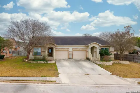
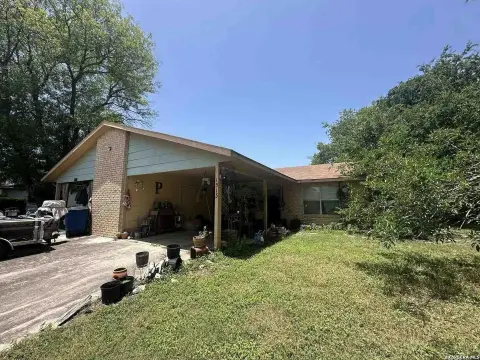
1172 Linde St New Braunfels, TX 78130-5981
Property profile & analytics
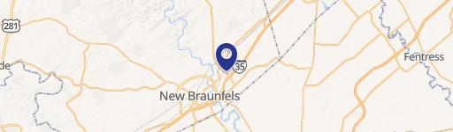
1172 Linde St, New Braunfels, TX 78130-5981
- Mobile home & RV parks
- 3 SF
- 0.34 lot acres
Property ID
US82-8912922
The Realmo ID is a unique identifier assigned to every property, incorporating country codes and precise geo-coordinates for 300x300-foot land blocks. It enables standardized data collection and seamless integration of disparate sources such as ownership, tax, title data and physical specifications. By aggregating current and historical records, the Realmo ID powers advanced analytics and delivers deep, verifiable insights for real estate professionals.
Location Intelligence
Current Use by Public Records
- Mobile home & RV parks
Property Details for 1172 Linde St
- Year built
- 1980
- Lot size
- 0.34 lot acres
- Property type
- Mobile home & RV parks
- APN
- 60-0950-0027-05
- APU
- 600950002705
Sales History
| Date | Price | Buyer | Seller | Deed Type | Mortgage |
|---|---|---|---|---|---|
| Jan 20, 2017 | — | Walnut 88 Ltd | — | Trustees Deed · related | — |
| Aug 16, 2016 | — | Walnut 88 Ltd | — | Trustees Deed · related | — |
| Dec 14, 2010 | — | Walnut 88 Ltd | Schumacher Rentals LLC | Grant Deed · related | — |
| Feb 22, 2009 | — | Schumacher Rentals LLC | Owner Name Unavailable | Grant Deed · related | — |
Value Estimations
based on Realmo’s proprietary methodology
-
AI approach
-
CAP approach
-
Comparable approach
-
Alternative Use
Get a detailed, property-specific estimation — fast and free
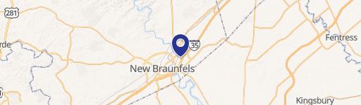
Location Insight
- Map
- Local Demand
- City
- New Braunfels
- County
- Comal
- State
- Texas
- Longitude
- -98.1231
- Latitude
- 29.6836
- CBSA code
- 41700
- CBSA name
- SAN ANTONIO, TX METROPOLITAN STATISTICAL AREA
Property Tax & Assessments
Tax date
Tax Amount
Assessed Land Value
Assessed Improvement Value
Total Assessed Value
Applied Tax Rate
Land Market Value
Improvement Market Value
Total Market Value
2023
$4,228
$221,571
$23,320
$244,891
-
$221,571
$23,320
$244,891