1061 Riv Rd Buxton, ME 04093-6021
Property profile & analytics
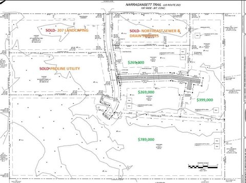
1061 Riv Rd, Buxton, ME 04093-6021
- Banks
- 1,592 SF
- 4.50 lot acres
Property ID
US42-0879421
The Realmo ID is a unique identifier assigned to every property, incorporating country codes and precise geo-coordinates for 300x300-foot land blocks. It enables standardized data collection and seamless integration of disparate sources such as ownership, tax, title data and physical specifications. By aggregating current and historical records, the Realmo ID powers advanced analytics and delivers deep, verifiable insights for real estate professionals.
Location Intelligence
Current Use by Public Records
- Banks
Property Details for 1061 Riv Rd
- Year built
- 1870
- Lot size
- 4.50 lot acres
- Zone code
- BUXTON
- Property type
- Banks
- APN
- BUXT M:0013 B:0026
- APU
- BUXTM0013B0026
Sales History
| Date | Price | Buyer | Seller | Deed Type | Mortgage |
|---|---|---|---|---|---|
| Jun 15, 2017 | — | Susanne Y Schaller | Jaques,john | Quit Claim Deed | — |
| May 4, 2017 | $145,000 | John Jaques | Wells Fargo Bk NA | Quit Claim Deed | — |
| Feb 23, 2017 | — | Wells Fargo Bk NA | Wells Fargo Bk NA | Quit Claim Deed · related | — |
| Feb 8, 2011 | — | Michelle L Hall | — | Deed Of Trust · related | $222k · Primary Residential Mortgage |
| Jun 4, 2010 | — | Us Bank NA | Vincent,gary W | Grant Deed · related | — |
| Dec 19, 2005 | — | Gary W Vincent | — | Deed Of Trust · related | $250k · Northside Mortgage Group |
Value Estimations
based on Realmo’s proprietary methodology
-
AI approach
-
CAP approach
-
Comparable approach
-
Alternative Use
Get a detailed, property-specific estimation — fast and free
Location Insight
- Map
- Local Demand
- City
- Buxton
- County
- York
- State
- Maine
- Longitude
- -70.543
- Latitude
- 43.6152
- CBSA code
- 38860
- CBSA name
- PORTLAND-SOUTH PORTLAND-BIDDEFORD, ME METROPOLITAN STATISTICAL AREA
Property Tax & Assessments
Tax date
Tax Amount
Assessed Land Value
Assessed Improvement Value
Total Assessed Value
Applied Tax Rate
Land Market Value
Improvement Market Value
Total Market Value
2023
$5,132
$121,000
$371,000
$492,000
-
$0.00
$0.00
$0.00