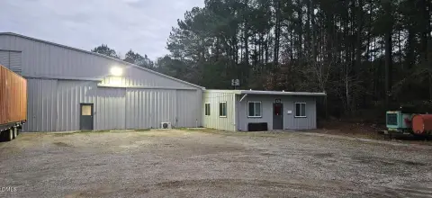
1021 Thorpe Rd Rocky Mount, NC 27804-1920
Property profile & analytics
1021 Thorpe Rd Rocky Mount, NC 27804-1920
- Warehouses
- 112,828 SF
- 27.69 lot acres
Property ID
US53-2807988
The Realmo ID is a unique identifier assigned to every property, incorporating country codes and precise geo-coordinates for 300x300-foot land blocks. It enables standardized data collection and seamless integration of disparate sources such as ownership, tax, title data and physical specifications. By aggregating current and historical records, the Realmo ID powers advanced analytics and delivers deep, verifiable insights for real estate professionals.
Location Intelligence
Current Use by Public Records
- Crown LSP group inc. / Business To Business Service
Property Details for 1021 Thorpe Rd
- Year built
- 1971
- Lot size
- 27.69 lot acres
- Property size
- 112,828 SF
- Zone code
- I2
- Property type
- Warehouses
- Property subtype
- Self storage facilities
- APN
- 385007-58-2749
- APU
- 385007582749
Value Estimations
based on Realmo’s proprietary methodology
-
CAP approach
- CAP Return
- Estimation
- 6%
- $16,335,000
- 6.5%
- $15,075,000
- 7%
- $14,000,000
-
Comparable approach
- Method
- Estimation
- Statistic Estimate
- $14,923,000
- AI Estimate
- $13,781,000
Market price range: $6.21M - $29.4MMarket price range: $9.17M - $26.3M -
Alternative Use
- Use
- Estimation
- WAREHOUSE, STORAGE
- $17,935,000 Current use
- COMMERCIAL (GENERAL)
- $16,830,000 Change: -6% Conversion: Difficult
Get a detailed, property-specific estimation — fast and free
Location Insight
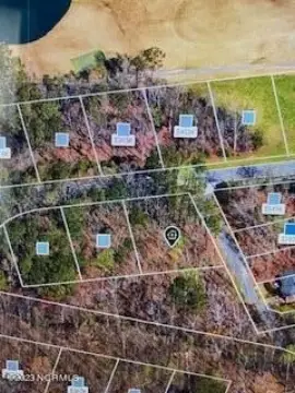
- Map
- Local Demand
- City
- Rocky Mount
- County
- Nash
- State
- North Carolina
- Longitude
- -77.7996
- Latitude
- 35.967
- CBSA code
- 40580
- CBSA name
- ROCKY MOUNT, NC METROPOLITAN STATISTICAL AREA
Property Tax & Assessments
Tax date
Tax Amount
Assessed Land Value
Assessed Improvement Value
Total Assessed Value
Applied Tax Rate
Land Market Value
Improvement Market Value
Total Market Value
2024
$17,750
$494,860
$1,461,800
$1,956,660
-
$494,860
$1,461,800
$1,956,660