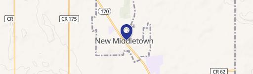
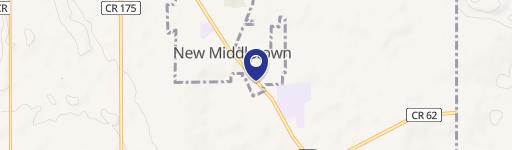
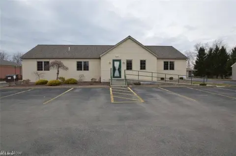
10201 Main St New Middletown, OH 44442
Property profile & analytics
10201 Main St, New Middletown, OH 44442
- Drive through restaurants
- 2,543 SF
- 0.52 lot acres
Property ID
US66-1678759
The Realmo ID is a unique identifier assigned to every property, incorporating country codes and precise geo-coordinates for 300x300-foot land blocks. It enables standardized data collection and seamless integration of disparate sources such as ownership, tax, title data and physical specifications. By aggregating current and historical records, the Realmo ID powers advanced analytics and delivers deep, verifiable insights for real estate professionals.
Location Intelligence
Current Use by Public Records
- Dairy Queen Grill & Chill / Restaurant / Take-out & Catering
Property Details for 10201 Main St
- Year built
- 1966
- Lot size
- 0.52 lot acres
- Property type
- Drive through restaurants
- APN
- 03-001-0-028.00-0
- APU
- 30010028000
Sales History
| Date | Price | Buyer | Seller | Deed Type | Mortgage |
|---|---|---|---|---|---|
| Nov 3, 2020 | — | Randy Rapp | Elaine K Rapp | Transfer On Death Deed · related | — |
| Oct 5, 2017 | — | Ronald I Rapp | Ronald L Rapp | Intrafamily Transfer · related | — |
| Jul 18, 2016 | — | Ronald L Rapp | — | Deed · related | $175k · Talmer Bank And Trust |
Value Estimations
based on Realmo’s proprietary methodology
-
AI approach
-
CAP approach
-
Comparable approach
-
Alternative Use
Get a detailed, property-specific estimation — fast and free
Location Insight
- Map
- Local Demand
- City
- New Middletown
- County
- Mahoning
- State
- Ohio
- Longitude
- -80.5648
- Latitude
- 40.9701
- CBSA code
- 49660
- CBSA name
- YOUNGSTOWN-WARREN-BOARDMAN, OH-PA METROPOLITAN STATISTICAL AREA
Property Tax & Assessments
Tax date
Tax Amount
Assessed Land Value
Assessed Improvement Value
Total Assessed Value
Applied Tax Rate
Land Market Value
Improvement Market Value
Total Market Value
2023
$4,166
$15,800
$54,610
$70,410
-
$45,130
$156,020
$201,150