1010 Hornaday Rd Brownsburg, IN 46112-1972
Property profile & analytics
1010 Hornaday Rd, Brownsburg, IN 46112-1972
- Assisted living facilities
- 47,226 SF
- 3.00 lot acres
Property ID
US31-0780506
The Realmo ID is a unique identifier assigned to every property, incorporating country codes and precise geo-coordinates for 300x300-foot land blocks. It enables standardized data collection and seamless integration of disparate sources such as ownership, tax, title data and physical specifications. By aggregating current and historical records, the Realmo ID powers advanced analytics and delivers deep, verifiable insights for real estate professionals.
Location Intelligence
Current Use by Public Records
- Brownsburg Health Care Center / Nursing Home
Property Details for 1010 Hornaday Rd
- Year built
- 1971
- Construction
- WOOD
- Lot size
- 3.00 lot acres
- Property type
- Assisted living facilities
- Property subtype
- Retirement homes
- APN
- 32-07-14-200-012.000-016
- APU
- 320714200012000016
Sales History
| Date | Price | Buyer | Seller | Deed Type | Mortgage |
|---|---|---|---|---|---|
| Jul 7, 2025 | — | 1010 Hornaday Road In LLC | — | Deed · related | $40M · Metropolitan Commercial Bank |
| Mar 13, 2024 | — | 1010 Hornaday Road In LLC | Brownsburg Health Care Center LLC | Warranty Deed | — |
Value Estimations
based on Realmo’s proprietary methodology
-
AI approach
- Method
- Estimation
- ML approach
- $670,000
Get a detailed, property-specific estimation — fast and free
Location Insight
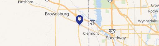
- Map
- Local Demand
- City
- Brownsburg
- County
- Hendricks
- State
- Indiana
- Longitude
- -86.3833
- Latitude
- 39.8302
- CBSA code
- 26900
- CBSA name
- INDIANAPOLIS-CARMEL-ANDERSON, IN METROPOLITAN STATISTICAL AREA
Property Tax & Assessments
Tax date
Tax Amount
Assessed Land Value
Assessed Improvement Value
Total Assessed Value
Applied Tax Rate
Land Market Value
Improvement Market Value
Total Market Value
2023
$35,690
$255,000
$3,144,000
$3,399,000
-
$255,000
$3,144,000
$3,399,000