100 Valley View Dr NW Cartersville, GA 30121
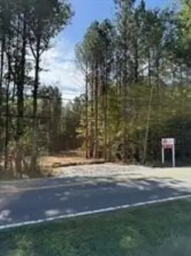
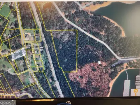
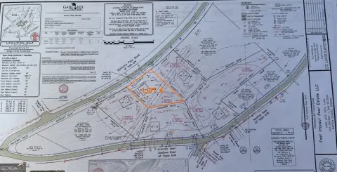
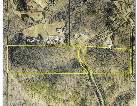
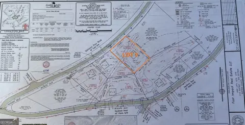
Whether you're looking to build a multi-family investment property, establish a personal residence with room to grow, or hold land for future appreciation, this Cartersville property is rich with potential. Don't miss the chance to explore all the possibilities! -4.07 AC. ZONED R-2 BARTOW COUNTY [Residential District (conventional or industrialized duplexes, triplexes, or quadraplexes)] -FRONTAGE ON VALLEY VIEW DRIVE -UTILITIES: WATER, POWER -TOPOGRAPHY: VARIES – ROLLING TO STEEP -LOCATED ON BOTH SIDES FOR ROAD -2 SEPARATE PARCEL IDS INCLUDED IN SALE -PER ZONING EACH PARCEL COULD HOUSE MULTI UNIT HOUSING – SEE BELOW -WOODED -6.3 +/- MILES TO DOWNTOWN CARTERSVILLE -50.2 +/- MILES TO DOWNTOWN ATLANTA -COMMUNICATIONS TOWER ON PROPERTY – CAN BE REMOVED BY THE SELLER – SUBJECT TO NEGOTIATION OF TERMS ON A PURCHASE AND SALES AGREEMENT. -POSSIBLE OPPORTUNITY TO CLEAR SOME TREES AND HAVE A SHORT RANGE VIEW TO THE WEST OR LEAVE IT AS IS FOR WOODED SECLUSION. Information Deemed Reliable, But Cannot Be Guaranteed. Buyer to verify all information in their due diligence. BARTOW COUNTY ZONING CODE Sec. 7.5. - R-2 residential district (conventional or industrialized duplex, triplex, or quadraplex housing). modified 7.5.1 Purpose. The R-2 residential district is established primarily to accommodate the development of conventional or industrialized duplexes, triplexes, and quadraplexes (aka fourplex). The R-2 district is a residential district. 7.5.2 Area, yard, height and buffer requirements. The following requirements apply in the R-2 district: Minimum lot size: On sewer: 8,000 square feet for duplex, 12,000 square feet for triplex and 16,000 square feet for quadplex. On septic, 26,000 square feet or greater as required by the county health department. See section 5.5. Minimum lot width at street R/W (on existing road): 200 feet. Minimum lot width at street R/W (in new development): 65 feet for duplex, 90 feet for triplex or quadplex; reduce by ½ for cul-de-sac lot. Front yard setback (from right-of-way): 25 feet. Side yard setback (from property line): 10 feet. Rear yard setback (from property line): 25 feet. Maximum building and structure height: 50 feet. Buffers: 15 feet adjoining single-family residential use property. See section 8.2. Special agricultural protection buffers: See Sec. 8.2.3 for buffers required for homes built adjacent to existing agricultural activities.
Cap rate
Implied · in-place · derived from last sale + estimated NOIValue
AI, CAP & Alternative Use estimations · Realmo proprietary blendComparables
6 recent transactions · within 1.5 miComparable in this City
Similar Nearby for Sale
Similar Nearby for Lease


Property description
Physical attributes from public recordsZoning & alternative use
No recorded transactions found for this property.
Costs & Benchmarks
Operating expenses, capex projections, utility benchmarks, and submarket comparables — all in one view.
Risks
Flood, climate, environmental, title, and tenant-concentration risk — surfaced with mitigations and source citations.


