Beloat Rd Buckeye, AZ 85326
Property Lookup
Property profile & analytics
Location Intelligence
Current Use by Public Records
- Land
Property Details for 0 Beloat Rd
- Lot size
- 315.53 lot acres
- Property type
- Land
Description
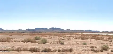
This exceptional 315.53-acre commercial land parcel presents a significant investment opportunity in Buckeye, Arizona. Located in Maricopa County, this property boasts a prime location with easy access via W Beloat Rd and is zoned RU-43, allowing for a variety of commercial development possibilities. The asking price is $138,743,456, translating to a land value of $8 per square foot. This expansive tract offers considerable potential for large-scale commercial projects. The property consists of multiple parcels, identified by the following Assessor's Parcel Numbers (APNs): 400-43-003G, 400-43-003D, 400-43-006, 400-43-005, 400-44-017, 400-45-018, and 400-43-003F. Situated in the rapidly growing city of Buckeye, AZ, 85326, this location offers excellent access to major transportation routes and a burgeoning market. The latitude and longitude coordinates are 33.3632199 and -112.5786861 respectively. This is a rare opportunity to acquire a substantial land holding with significant upside potential in a dynamic and expanding region. Serious inquiries only.
Value Estimations
based on Realmo’s proprietary methodology
-
AI approach
-
CAP approach
-
Comparable approach
-
Alternative Use
Location Insight
- Map
- Local Demand
- City
- Buckeye
- County
- Maricopa
- State
- Arizona
- Longitude
- -112.579
- Latitude
- 33.3632