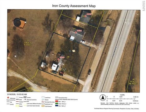
0 Highway M Ironton, MO 63650
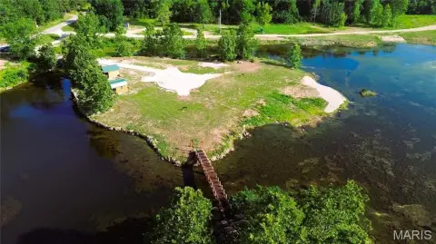
This exceptional 31.67-acre property in Iron County, Missouri, presents a rare opportunity for outdoor enthusiasts and those seeking a tranquil retreat. Located on Hwy M near Ironton (zip code 63650), this mostly level lot offers easy access and boasts a picturesque setting. Mature oak and cedar trees create a naturally wooded sanctuary, enhanced by the presence of Stouts Creek flowing across the entire property. The land is rich with wildlife, including wild hogs. Electricity is available on two sides of the property, providing ample options for building a home or cabin. Multiple prime building locations exist, allowing for customized development. The property's proximity to Arcadia Valley (2.7 miles) adds to its appeal, offering a balance of seclusion and convenient access to amenities. This unique property is ideal for those seeking a weekend getaway or a permanent residence in a peaceful, natural environment. The combination of wooded acreage, creek frontage, and convenient location makes this a truly exceptional offering. Don't miss this chance to own a piece of Missouri's natural beauty.
Cap rate
Implied · in-place · derived from last sale + estimated NOIValue
AI, CAP & Alternative Use estimations · Realmo proprietary blendComparables
6 recent transactions · within 1.5 miComparable in this City


Similar Nearby for Sale


Property description
Physical attributes from public recordsZoning & alternative use
No recorded transactions found for this property.
Costs & Benchmarks
Operating expenses, capex projections, utility benchmarks, and submarket comparables — all in one view.
Risks
Flood, climate, environmental, title, and tenant-concentration risk — surfaced with mitigations and source citations.


