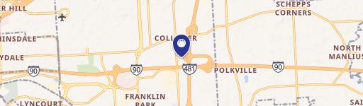
0 Fisher Rd East Syracuse, NY 13057
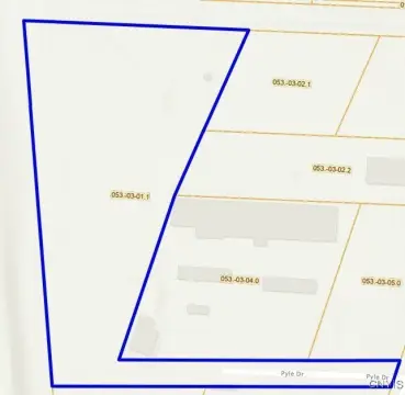
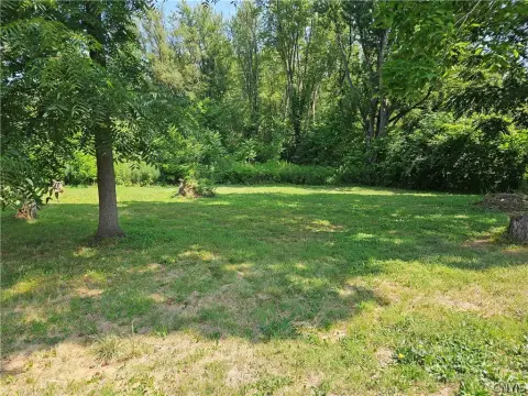
This exceptional 10.1-acre land parcel presents a unique investment opportunity in East Syracuse, NY. Located on Fisher Rd, with a Syracuse mailing address and zip code 13057, this property is zoned RA Restricted Agricultural Districts. The parcel is identified by Tax ID: 074-01-02.0. Access is via a deeded easement. Situated between several municipally and utility-owned properties, this land offers potential for future development or serves as a strong buy-and-hold investment. The property's classification includes commercial, farm, and residential uses, providing flexibility for various development scenarios. Its location in Onondaga County, New York, offers proximity to amenities and infrastructure. The wetland nature of the parcel should be considered in any development plans. Serious inquiries only. Coordinates: Latitude 43.048711, Longitude -76.034778. Asking price: $9,950.
Cap rate
Implied · in-place · derived from last sale + estimated NOIValue
AI, CAP & Alternative Use estimations · Realmo proprietary blendComparables
6 recent transactions · within 1.5 miComparable in this City

Similar Nearby for Sale


Similar Nearby for Lease


Property description
Physical attributes from public recordsZoning & alternative use
No recorded transactions found for this property.
Costs & Benchmarks
Operating expenses, capex projections, utility benchmarks, and submarket comparables — all in one view.
Risks
Flood, climate, environmental, title, and tenant-concentration risk — surfaced with mitigations and source citations.


