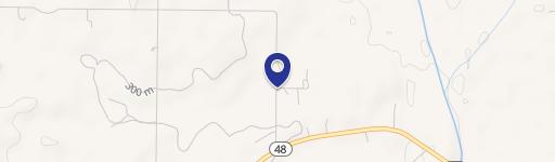
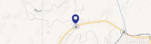
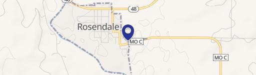
0 Hwy 48 Hwy Rosendale, MO 64483
This exceptional 6.9-acre (more or less) property in Andrew County, Missouri, presents a unique opportunity for agricultural endeavors or rural development. Located conveniently off Highway 48 in Rosendale, MO, zip code 64483, this parcel boasts a desirable blend of open land and natural features. The expansive acreage offers ample space for a variety of uses, from cultivating crops to raising livestock, or even establishing a private retreat. The property's location in Andrew County provides access to local amenities and infrastructure while maintaining a peaceful, rural setting. With its strategic location and considerable size, this land offers significant potential for growth and development. The asking price is $125,000. This is a rare opportunity to acquire a substantial piece of Missouri farmland with significant potential for future development and investment. Serious inquiries are encouraged to explore the possibilities this property offers. The latitude and longitude coordinates are 40.0506104 and -94.806003 respectively. Don't miss this chance to own a piece of Missouri's agricultural heartland.
Cap rate
Implied · in-place · derived from last sale + estimated NOIValue
AI, CAP & Alternative Use estimations · Realmo proprietary blendComparables
6 recent transactions · within 1.5 miComparable in this City


Property description
Physical attributes from public recordsZoning & alternative use
No recorded transactions found for this property.
Costs & Benchmarks
Operating expenses, capex projections, utility benchmarks, and submarket comparables — all in one view.
Risks
Flood, climate, environmental, title, and tenant-concentration risk — surfaced with mitigations and source citations.


