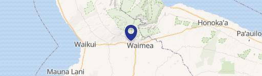
and Ala Ohia Cor Of Pukalani Rd Waimea, HI 96743
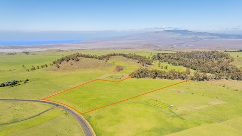
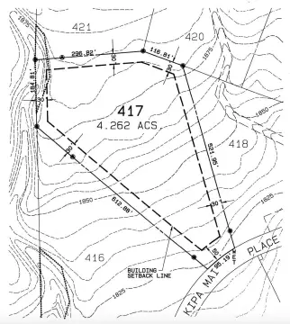
This exceptional 4.1-acre parcel, located at the corner of Pukalani Road and Ala Ohia in Waimea, Hawaii (zip code 96743), presents a unique investment opportunity. Situated in a highly desirable area, this level lot boasts 900 feet of frontage on Pukalani Road and an additional 250 feet on Ala Ohia Road. The property is zoned CV 7.5 Village Commercial, allowing for a variety of uses, including multifamily residential and commercial developments such as clinics, nursing homes, and daycares. Preliminary plans suggest the potential for up to nine six-plex buildings, totaling 54 units ranging from 790 to 1,000 square feet. The location offers unparalleled convenience, with proximity to supermarkets, shopping centers, educational institutions, and North Hawaii Community Hospital directly across the street. All major utilities are readily available, including Hawaiian Electric Light Company (electric), Hawaii County Department of Water Supply (water), and Waimea Wastewater Company, Inc. (sewer). Importantly, the property is located in FEMA Zone X, outside the 500-year flood plain. The APN is (3) 6-7-2-56. This is a rare opportunity to acquire a large, well-located commercial parcel in a thriving Hawaiian community.
Cap rate
Implied · in-place · derived from last sale + estimated NOIValue
AI, CAP & Alternative Use estimations · Realmo proprietary blendComparables
6 recent transactions · within 1.5 miComparable in this City


Similar Nearby for Sale


Similar Nearby for Lease

Property description
Physical attributes from public recordsZoning & alternative use
No recorded transactions found for this property.
Costs & Benchmarks
Operating expenses, capex projections, utility benchmarks, and submarket comparables — all in one view.
Risks
Flood, climate, environmental, title, and tenant-concentration risk — surfaced with mitigations and source citations.


