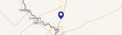
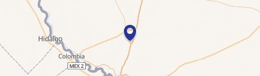
0000 Sulfur Mine Rd Laredo, TX 78045
This exceptional 4.912-acre industrial land parcel presents a compelling investment opportunity in Laredo, Texas. Situated at 0000 Sulfur Mine Rd, Webb County, zip code 78045, this property boasts a strategic location near both the World Trade Bridge and the Columbia Bridge, offering unparalleled access to key transportation routes. The permitted zoning, designated as "08 All of Mines Rd to IH 35," allows for a wide range of industrial uses, making it particularly attractive for transportation and logistics companies. The expansive lot size provides ample space for development, accommodating significant infrastructure and operational needs. With its convenient location and flexible zoning, this property is poised for immediate development and promises strong returns for the discerning investor. The asking price for this exceptional industrial land is $950,000. The property's coordinates are latitude 27.650081 and longitude -99.6152483. This is a rare opportunity to acquire a substantial industrial land parcel in a thriving Texas border city.
Cap rate
Implied · in-place · derived from last sale + estimated NOIValue
AI, CAP & Alternative Use estimations · Realmo proprietary blendComparables
6 recent transactions · within 1.5 miComparable in this City


Similar Nearby for Sale


Similar Nearby for Lease


Property description
Physical attributes from public recordsZoning & alternative use
No recorded transactions found for this property.
Costs & Benchmarks
Operating expenses, capex projections, utility benchmarks, and submarket comparables — all in one view.
Risks
Flood, climate, environmental, title, and tenant-concentration risk — surfaced with mitigations and source citations.


