Property summary
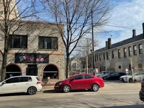
This exceptional redevelopment opportunity presents a unique assemblage of four buildings totaling approximately 82,250 square feet situated on a 2.14-acre lot (approximately 93,000 square feet total) in Chicago's vibrant Pilsen neighborhood. The property boasts a highly visible corner location, just steps from the CTA Pink Line and the 18th Street retail corridor. The assemblage includes a former convent (Building 1, approximately 25,200 square feet over five floors, featuring original hardwood floors, wood molding, and stained glass windows), St. Adalbert's Church (Building 2, approximately 25,200 square feet with striking architecture, twin 185-foot towers, and nearly 60-foot ceiling heights), a rectory (Building 3, approximately 10,500 square feet over four floors), and a school (Building 4, approximately 20,955 square feet over three floors with a courtyard and playground). The property also includes a large garage and approximately 44,000 square feet of additional land suitable for future development or parking. Located in a Transit-Oriented Development (TOD) zone, this property offers potential for increased density and reduced parking minimums. Its proximity to I-90/94, I-55, and I-290, as well as its one-mile distance from Chicago's Loop, the University of Illinois Chicago (UIC), and the Illinois Medical District, makes it an ideal location for various development projects, including potential student housing or medical facilities. The property's zoning is RT-4. The buildings were constructed in 1912. The Cook County Assessor's Parcel Number (APN) is 17-19-403-001,-002,-0000. The asking price is $3,950,000.
Property profile
VerifiedCap rate & NOI
Current use
-
High School
Location
Value estimations
Owner & transaction history
Comparables
6 recent transactions · within 1.5 miComparable in this City


Similar Nearby for Sale



Similar Nearby for Lease


Value estimation
Instant AI valuation built from comps, income signals, and proprietary benchmarks. A defensible range, not a single guess.
from $99/month
Cap rate
Cap rate calculated from real income and expense signals, benchmarked against sales of similar assets nearby.
from $99/month
Property description
Physical attributes from public recordsZoning & alternative use
Zoning
The recorded zoning designation, what the district officially allows, and the municipal source it comes from.
No zoning code is on file for this parcel. Zoning coverage grows with every catalog release — check back, or open Location Intelligence for use analysis of this corner.
Find the owner behind the property.
Unlock the evidence behind ownership: portfolio, transactions, debt and signals that help you decide who to contact next.
Registration is required before any owner information is shown.
- Full Property Data
- Historical Records
- Value Estimation
- NOI Potential
- Cap Rate Calculation
- Ownership
- Location Insight
- Alternative use
- Local Zoning Insight
Cancel anytime.
- 30 reports a month
- Location Analytics
- Market Trends
- Full Property Data
- Historical Records
- Value Estimation
- NOI Potential
- Cap Rate Calculation
- Ownership
- Location Insight
- Alternative use
- Local Zoning Insight
Cancel anytime.
- 300 reports a month
- Location Analytics
- Market Trends
- Full Property Data
- Historical Records
- Value Estimation
- NOI Potential
- Cap Rate Calculation
- Ownership
- Location Insight
- Alternative use
- Local Zoning Insight
and get 1 Light Report
- Property Information
- Historical Records
- Value Estimation
- NOI Potential
- Cap Rate Potential
- Location Insight
- Alternative use
- Local Zoning Insight


