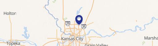
0 Barry Rd Kansas City, MO 64156
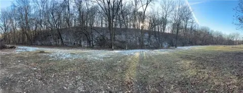
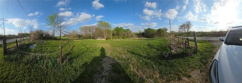
This exceptional 11.62-acre property presents a unique investment opportunity in North Kansas City, Missouri. Strategically located just off Highway 152 and Interstate 435 on NE Barry Road, this land boasts unparalleled accessibility and visibility. Currently zoned agricultural, the property offers immense potential for a variety of development projects, including multi-family residential, commercial ventures, or other business uses. A variance may be required to align with specific development plans. The site's advantageous location ensures convenient access to essential utilities. Water lines are readily available on both sides of the road, and the main sewer line is situated within a convenient 150 feet. The property's APN is 14-120-00-09-003.00, and it is held in trust. This prime location, coupled with its substantial size and proximity to major transportation arteries, makes it an ideal canvas for ambitious development projects. The asking price for this remarkable property is $1,300,000. Prospective buyers are responsible for verifying all information. Please note that a cell tower located nearby is not included in the 11.62-acre parcel. This is a rare opportunity to acquire a significant land holding in a rapidly growing area of Kansas City. Don't miss out on this chance to shape the future of North Kansas City.
-
Walgreens Cosmetic Store
-
T-Mobile Mobile Phone Store Electronics & Wireless Store
-
Freddy's Frozen Custard & Steakburgers Restaurant Take-out & Catering
-
Savers Discount Store
-
prairie-essentials Department Store
Cap rate
Implied · in-place · derived from last sale + estimated NOIValue
AI, CAP & Alternative Use estimations · Realmo proprietary blendComparables
6 recent transactions · within 1.5 miComparable in this City


Similar Nearby for Sale

Property description
Physical attributes from public recordsZoning & alternative use
No recorded transactions found for this property.
Costs & Benchmarks
Operating expenses, capex projections, utility benchmarks, and submarket comparables — all in one view.
Risks
Flood, climate, environmental, title, and tenant-concentration risk — surfaced with mitigations and source citations.


