Property summary
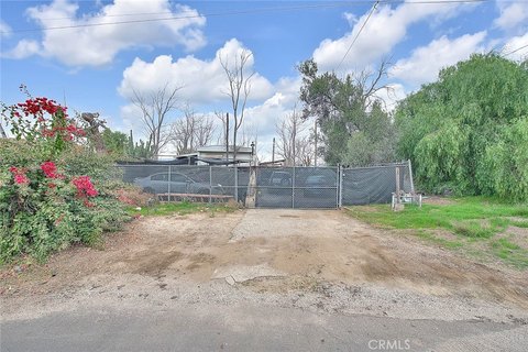
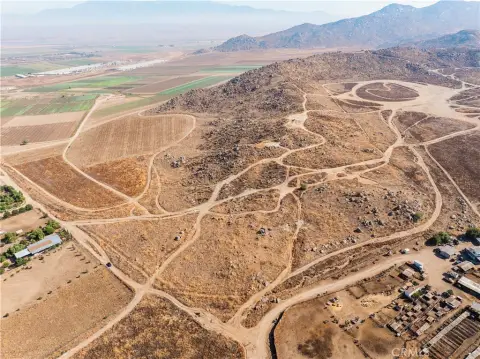
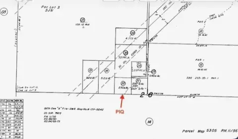
This exceptional 14.84-acre parcel, located at 14 Mt. Rudolph Rd, Nuevo, CA 92567 (APN 425240021), presents a unique opportunity for building a custom home or developing a smaller subdivision. Situated in the hills of Mt. Rudolph Estates, this R-A-10 zoned property boasts approximately 630 feet of frontage and an 813-foot back boundary line within an 18-lot subdivision with no HOA. Enjoy breathtaking views of the mountains, hills, and valley lights, along with the privacy afforded by natural shrubs and rock formations. The land features existing infrastructure including a septic tank area, propane hookup, and readily available electricity and water. Conveniently located between Menifee, Murrieta, and San Jacinto/Hemet, this property offers easy access to I-215, Hwy 79, Hwy 74, and the Ramona Expressway, providing a straightforward commute. Nearby amenities include expansive shopping areas, restaurants, and services along Newport Road, and Perris Lake offers recreational opportunities just a short drive away. The area is characterized by single-family ranches and homes on larger lots, with newer tracts on smaller lots also present. The property's location within the Perris Unified School District and proximity to San Jacinto College adds to its appeal. This owner/builder opportunity allows for the creation of a truly custom estate in a rapidly growing rural area with planned future subdivisions, schools, parks, and commercial projects along the Ramona Expressway. The asking price is $549,000.
Property profile
VerifiedCap rate & NOI
Location
Value estimations
Owner & transaction history
Comparables
6 recent transactions · within 1.5 miComparable in this City


Similar Nearby for Sale


Value estimation
Instant AI valuation built from comps, income signals, and proprietary benchmarks. A defensible range, not a single guess.
from $99/month
Cap rate
Cap rate calculated from real income and expense signals, benchmarked against sales of similar assets nearby.
from $99/month
Property description
Physical attributes from public recordsZoning & alternative use
Zoning
The recorded zoning designation, what the district officially allows, and the municipal source it comes from.
No zoning code is on file for this parcel. Zoning coverage grows with every catalog release — check back, or open Location Intelligence for use analysis of this corner.
Find the owner behind the property.
Unlock the evidence behind ownership: portfolio, transactions, debt and signals that help you decide who to contact next.
Registration is required before any owner information is shown.
- Full Property Data
- Historical Records
- Value Estimation
- NOI Potential
- Cap Rate Calculation
- Ownership
- Location Insight
- Alternative use
- Local Zoning Insight
Cancel anytime.
- 30 reports a month
- Location Analytics
- Market Trends
- Full Property Data
- Historical Records
- Value Estimation
- NOI Potential
- Cap Rate Calculation
- Ownership
- Location Insight
- Alternative use
- Local Zoning Insight
Cancel anytime.
- 300 reports a month
- Location Analytics
- Market Trends
- Full Property Data
- Historical Records
- Value Estimation
- NOI Potential
- Cap Rate Calculation
- Ownership
- Location Insight
- Alternative use
- Local Zoning Insight
and get 1 Light Report
- Property Information
- Historical Records
- Value Estimation
- NOI Potential
- Cap Rate Potential
- Location Insight
- Alternative use
- Local Zoning Insight


